Where the birding is easy

One thing that struck me when I moved to Florida from Iowa back in the 1970’s was how easy it is down here to be a birder (at least the casual one that I am).

The birds are big! No more searching among the leaves in the forest to spot one. They are out and proud! A blue heron can stand about four feet tall and a drip-drying Anhinga can display a three-foot wingspan. Hard to hide when you’re that big.

My lengthy stays in the Northeast in recent years have reintroduced me to the rigors of  northern birdwatching.  I paddle along with friends and one of them says, “Wow, look at that finch.” And I hopelessly peer into the woods, seeing nothing.

“I don’t care about them unless they’re really very big,” never seems like an appropriate response, so I just mumble something encouraging.

So it was a nice ‘welcome back’ for me the other day when this green heron made an appearance in my Florida back yard.

IMG_1552c

Green heron, Lantana, FL (Photo by Ron Haines)

Posted in Nature, Paddling, Photos mostly | 2 Comments

Carhenge

I saw it briefly as I drove east on Route 2 in Alliance, Nebraska. Carhenge, the small sign said, and the arrow pointed left. It was too late to make the turn, so I continued on and doubled back. A short ways north on Flack Street, out of town actually, there it was, Carhenge.

IMG_0061c

Carhenge in Alliance, NE. (Photo by Ron Haines)

It was cold windy day, so I didn’t get much further than the parking lot and gift shop. I wasn’t dressed to go out wandering into the sculpture itself.

This place is not to be confused with Cadillac Ranch. Erected in 1974, that is a line of upended old Cadillacs half-buried nose first in a field near Amarillo, Texas. I’d passed by that a few days previously, but I do have my standards. Cadillac Ranch, by the way, was funded by local Panhandle oil heir Stanley Marsh III, who died in 2014 in the midst of some messy legal stuff involving young boys after years of rumored sexual proclivities and hushed-up complaints.

Unlike the Cadillac Ranch, where it is said to be tacitly OK to graffiti to one’s heart’s content, Carhenge is a more somber, serious sort of place, fitting I guess, given what it was meant to replicate.

Artist Jim Reinders had the opportunity to study the design and purpose of Stonehenge while living in England and built Carhenge as a memorial to his father, Herman, who once lived on the farm where the sculpture now stands.

IMG_0068c

Carhenge. (Photo by Ron Haines)

When relatives gathered following Herman’s death in 1982, the discussion turned to a memorial and the idea of a Stonehenge replica was developed. The family agreed to gather in five years and build it. The clan, about 35 strong, gathered in June 1987 and went to work.

According to Reinders, “It took a lot of work, sweat, and beers”. A few years later, he donated Carhenge and 10 acres around it to a nonprofit group, Friends of Carhenge. In 2013, the Friends group turned it over to the City of Alliance.

IMG_0065c

Bench at Carhenge, Alliance, NE. (Photo by Ron Haines)

Carhenge consists of 39 automobiles arranged in a circle measuring about 95 feet in diameter. Some are held upright in pits about 5 feet deep, trunk end down, and arches have been formed by welding automobiles atop the supporting models. The heelstone is a 1962 Cadillac.

I won’t go into all the history and details of Stonehenge itself, except to say it is a collection of standing stones, presumably because there were no automobiles back in 3000 BC.

Fair warning: In the course of doing some research for this I discovered there’s a toilet seat museum in San Antonio, TX. I was just there in June, renewing my friendship with the Riverwalk area, and completely missed the museum. Next year perhaps, and maybe also a visit then to the Spam Museum in Austin, MN. I passed a couple hours south of that in June, not realizing it was there.

Posted in Offbeat, Road trip | 4 Comments

Mississippi Missing

I could walk the river! It had taken me over 100 days in 2003 to paddle the entire Mississippi River. There was a scale model of it in Jackson, Mississippi, covering a couple hundred acres. I could walk what I’d paddled. Maybe do it in an hour or so.

I’d seen a reference to the Mississippi River Basin Model Waterways Experiment Station a while ago. I knew it was no longer in use, but it was still in existence.  Here’s a pretty cool home movie of it from 1969.

Fascinated by the idea, I put a visit there on my to-do list during my recent road trip to Texas from Connecticut. A quick internet search turned up an address and this comment, from a 2013 newspaper article, “overgrown, but open to the public.”

Here’s my 2015 description: “Not easy to find, completely overgrown, almost entirely destroyed by the elements, vandals and scavengers, but still recognizable for what it was if you know what you’re looking for.”

Yes, what was once a working model of the entire Mississippi River watershed (41 per cent of the US translated into a massive hydrological model with a vertical scale of 1:100 and a horizontal scale of 1:2000) is now an abandoned ruin largely hidden from view by trees and brush behind a chain link fence.

The massive slabs of concrete contoured to reflect the river basin and the ruins of some of the buildings that housed the data collection equipment are about all that’s left of it. And for some reason, much of the accordion-folded metal screening that was used to simulate woods and other vegetation along the waterway is still there too. Gone is most of the metal piping and all of the monitoring equipment, some of which was still around as recently as 2010, according to one account.

Entrance to the park is at lower left. The area outlined in red is the river model.

The river model is in Buddy Butts Park in Jackson, MS, within the wooded area marked in red. The cement slabs that formed the basin are still visible from the air. To the right of the river model are the cart track and the model airplane runways at the park.  Circled in black at lower left is the entrance to the park.

Lt. Gen. Eugene Reybold

Lt. Gen. Eugene Reybold

The project was conceived of and overseen by U.S. Army Corps of Engineers Lt. Gen. Eugene Reybold. Construction started in 1943 and was completed in 1966. The model was in operation from 1949 until 1973. Reybold began the construction with the labor of German prisoners of war from North Africa, who were being kept in an internment camp in nearby Clinton. The water source was an existing creek and when in operation an entire day on the river could be simulated in about five minutes.

The present day obscurity and condition of the place belie the important role it played during its productive years. In 1952, for example, faced with predictions of massive Missouri River flooding, the mayors of Omaha and Council Bluffs asked the Corps to use the model for the first time to predict flood stages.

This postcard from the model’s tourist era shows the view looking upriver at Vicksburg, MS (see sign on right). The smaller body of water is the Yazoo River, which meets the Mississippi at Vicksburg. The Mississippi takes a left at the mouth of the Yazoo and continues upstream.

This postcard from the model’s tourist era shows the view looking upriver at Vicksburg, MS (see sign on right). The smaller body of water under the sign is the Yazoo River, which meets the Mississippi at Vicksburg. The Mississippi in this photo veers left at the mouth of the Yazoo and continues upstream.

According to Places Journal, “Engineers issued prototype conditions to the newly installed instruments, generating simulations that forecasted likely events over the next month — crest stages, discharges, levee failure and more. As water poured through the Missouri River section of the model, the resulting data were relayed directly to aid workers in Omaha and Council Bluffs, who were able to respond with brigades of civilians and sandbags to points where levees needed to be raised only slightly; areas predicted to flood dramatically were evacuated. In total the Mississippi River Basin Model prevented an estimated $65 million in damages.”

Even more importantly, the successful use of the model forced planners to look at the basin as a whole and move beyond the thinking that had resulted in ineffective local approaches that had hindered flood control efforts in the 1920s and ‘30s.

From Places Journal: “For two decades, Reybold’s model was the tool used to extend this line of thinking throughout the Mississippi River Basin, determining flood control strategies from Montana to Louisiana. From 1949 to 1971, engineers completed 79 simulation packages at the basin model, with most requiring a minimum of two weeks and some as long as eight weeks. The tests ranged from altering the course of the river to spot-raising levee heights in vulnerable locations. The Basin Model Testing Record reads like a battle transcript. In February 1962, a series of hypothetical floods was introduced to the Ohio River. In 1967, the effects of roadway construction on the flow of the Mississippi River were tested in Lake County, Tennessee. In 1969, various channel alignments were examined in Baton Rouge, Louisiana, and basin-wide tests were conducted to verify the holding capacities of floodways and reservoirs throughout the lower basin.”

Images_9_2_6_MBM-USMapHowever, the computer age was coming to river basin modeling. The Corps’ Hydrologic Engineering Center had developed a river hydraulics software package in 1971. A study was set up to compare results of the two competing methodologies. The computer won and the physical model was used only sporadically after that.

By the early 1990s the Corps had abandoned it completely and it was turned over to the City of Jackson, which formed a park around it. What’s left of the 200-acre model is now behind a fence in the middle of Buddy Butts Park.

The park isn’t all that easy to find. It’s on the western fringe of Jackson, almost in

Entrance to Butts Park

Entrance to Butts Park

neighboring Clinton. The actual street address, 6180 McRaven Road according to the town’s website, isn’t at the park entrance. When I got to the eastern end of McRaven, I turned around and slowly made my way back west on the badly pot-holed road and finally spotted the entrance, set back off the north side of the road.

There, along with a driving range, soccer fields, a small cart track, a model airplane landing strip, mountain bike trail and disc golf course, is the river model. There is no sign saying what it is. If you know what you’re looking for you will find it, behind a fence that encircles a huge wooded area in the middle of the maintained area of the park.

What was once a unique and successful water flow testing model and tourist attraction (tours at 10 and 2) and named in 1993 as a Mississippi Landmark was declared in 2011 one of Mississippi’s 10 most endangered historic places.

Today, any reasonable person would just call it an overgrown, vandalized eyesore, albeit a barely visible one.

IMG_1542c

One of the several locked and blocked gates around the model. (Photo by Ron Haines)

One can see the remains of a bend in the river molded into the concrete. The material on the left is the accordion-folded metal screening that was used to simulate woods and other vegetation along the waterway. (Photo by Ron Haines)

One can see the remains of a bend in the river molded into the concrete. The material on the left is the accordion-folded metal screening that was used to simulate woods and other vegetation along the waterway. (Photo by Ron Haines)

Remains of a couple of the buildings. (Photo by Ron Haines)

Remains of a couple of the buildings. (Photo by Ron Haines)

A stretch of the river basin is visible winding though the trees. (Photo by Ron Haines)

A stretch of the river basin is visible winding though the trees. (Photo by Ron Haines)

Here's another visible section. (Photo by Ron Haines)

Here’s another visible section. (Photo by Ron Haines)

UPDATE:  In 2016 a non-profit group called Friends of the Mississippi River Basin Model was formed to restore the model and improve the park.  There is a facebook page and a website.  Check them out! 

Posted in Mississippi River Canoe Trip, Offbeat, Photos mostly, Road trip | 6 Comments

Heeeeere’s Johnny!!!

IMG_0092cI just realized today is Johnny Carson’s birthday so I figured it would be a good time to post a couple of photos from his boyhood home, Norfolk, NE, which I visited briefly earlier this summer.

Watching his opening monologue every night was one of those comfortable traditions that I never got away from when I lived in the Midwest, but once I settled in the Eastern Time Zone I usually found myself in bed by the time it came on.

It’s difficult to come up with something one doesn’t already know about him, but I found a couple items:

  1. The game “Twister” skyrocketed in popularity after he played an on-air game with actress Eva Gabor in 1966.
  2. After Carson joked on the show in December 1973 about an alleged shortage of toilet paper, panic buying and hoarding across the county caused a real shortage that lasted for weeks. He apologized in January.

I do recall, once I was in the celebrity business, being constantly confused by his first three wives. They were, in order, Joan, Joanne and Joanna. He once said he had married three similarly named women to avoid “having to change the monogram on the towels.”

All I know is I was happy when he married Alexis. He must have been too, as they were still married when he died in 2005.

IMG_0096c

Posted in Offbeat, Road trip | Leave a comment

Porch envy

I have porch envy. It’s not on a par with my garage envy, and doesn’t come close to my boathouse envy, but it is real.

Mark_Twain,_New_Hampshire,_1905

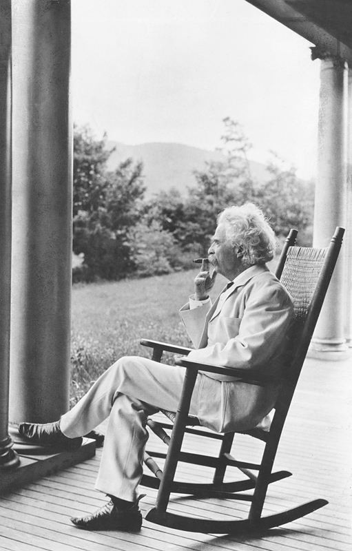
Mark Twain sits on a porch in New Hampshire in 1905

For someone with porch envy, Southeast Florida is an OK place to live, because front porches are few and far between down there. In short, there is not much to be envious about.

Drop me practically anywhere else in the country, however, and my head spins at all the gloriously welcoming front porches to be seen. Color me green.

My porch envy is usually strong enough that I can hardly drive through the older sections of a town without turning my head this way and that as I ogle the offerings. I have actually been honked at for driving too slowly. And if I don’t get a good enough look the first time I’ll swing around the block again.

I’ve been known to park the car and take a walk if I see a whole block of old houses with their porches, not one of them the same, all proudly lined up along the sidewalk.

I’m not talking about a bit of a stoop, or a platform outside a door that’s barely big enough to hold a welcome mat.

My family lived in this nicely porched house on Main Street in Harvey, IL, from the 1940's into the 1950's.

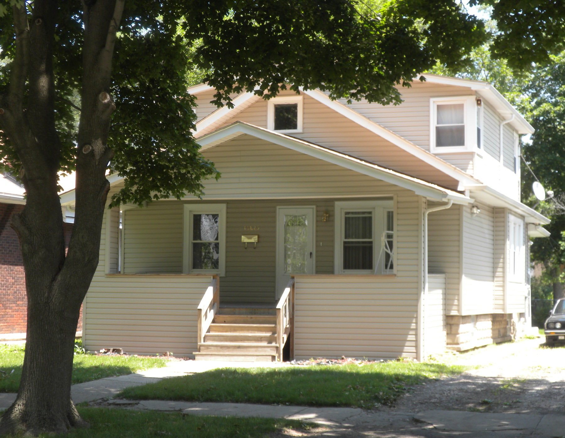
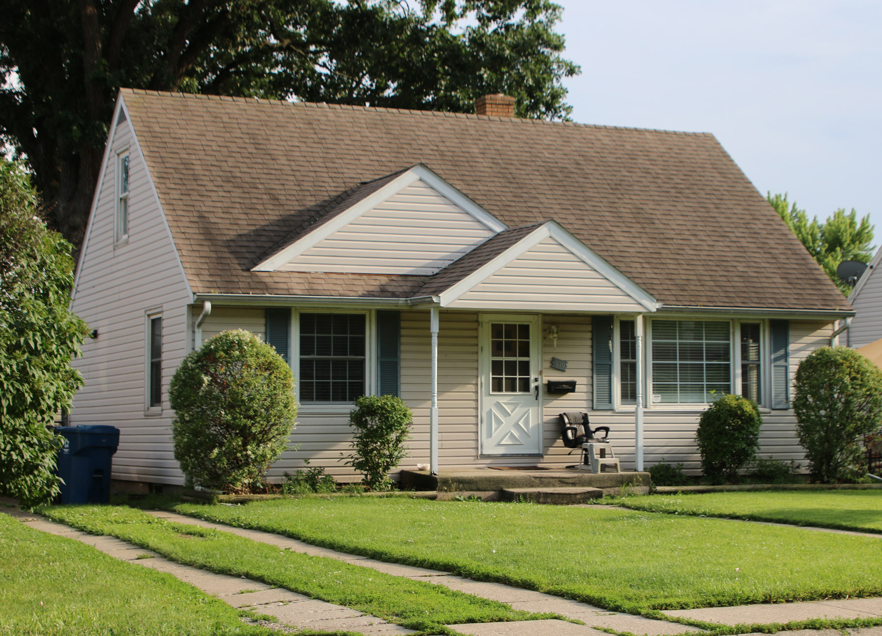
My family lived in this nicely porched house on Main Street in Harvey, IL, from the 1940’s into the 1950’s. (Photo by Roger Haines)

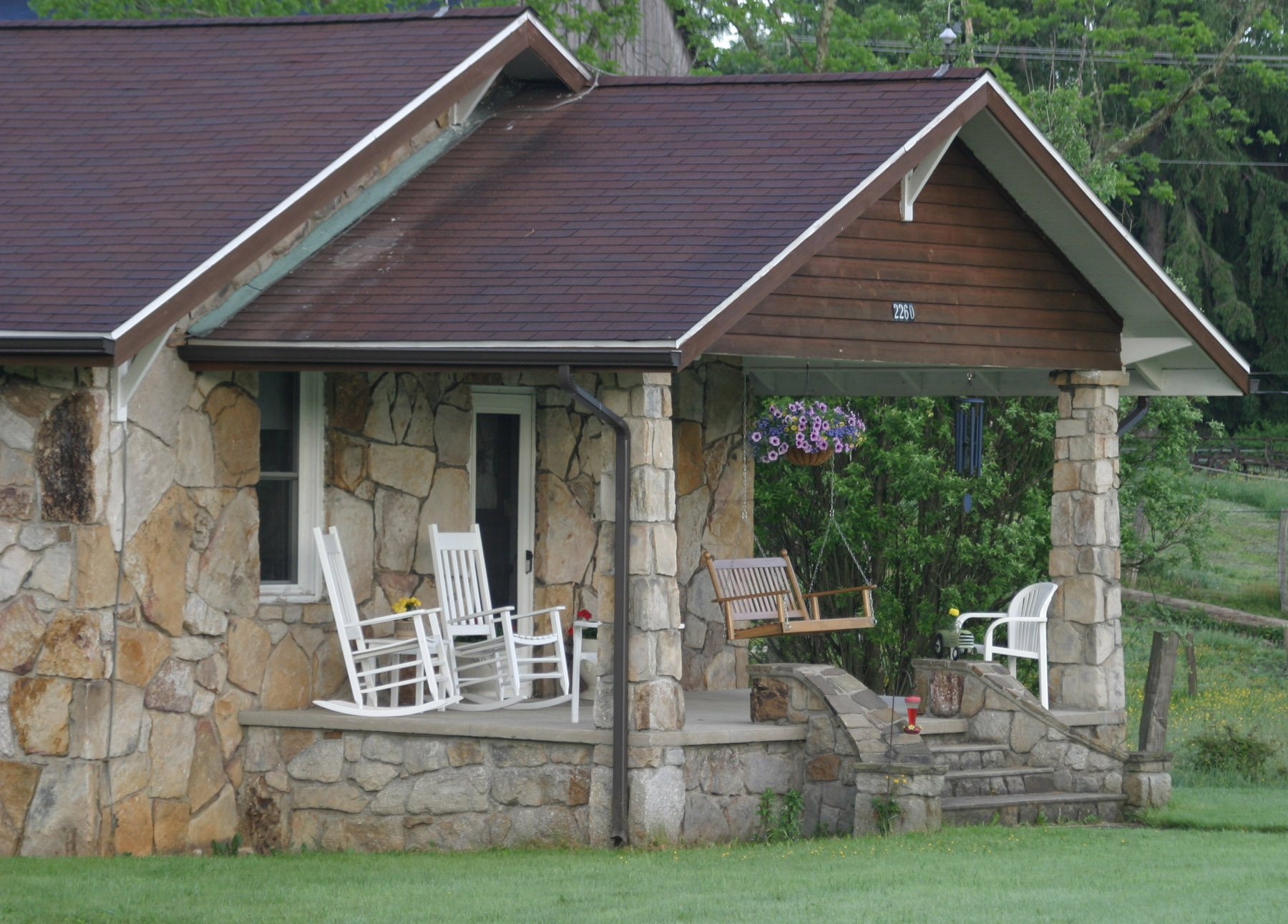
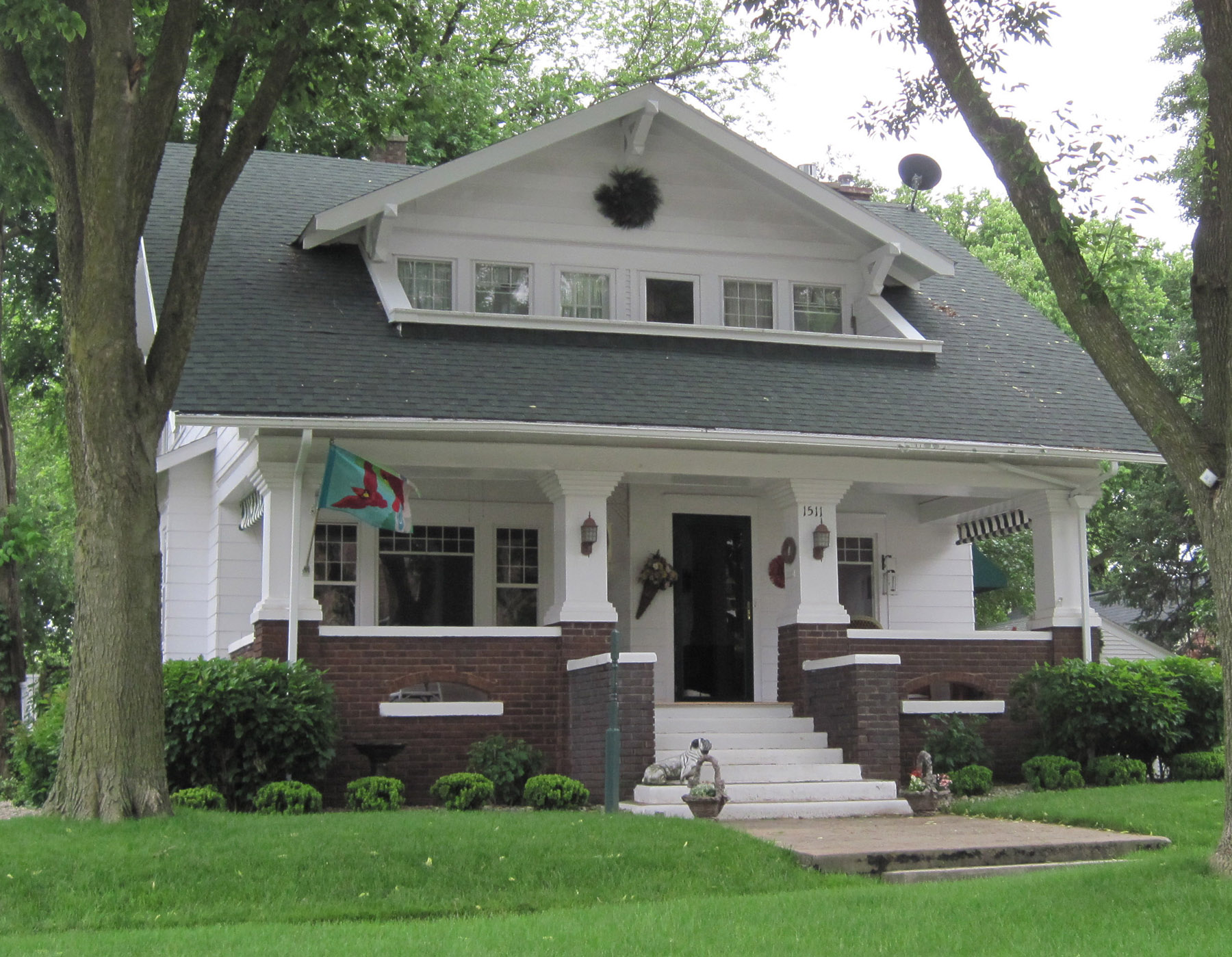
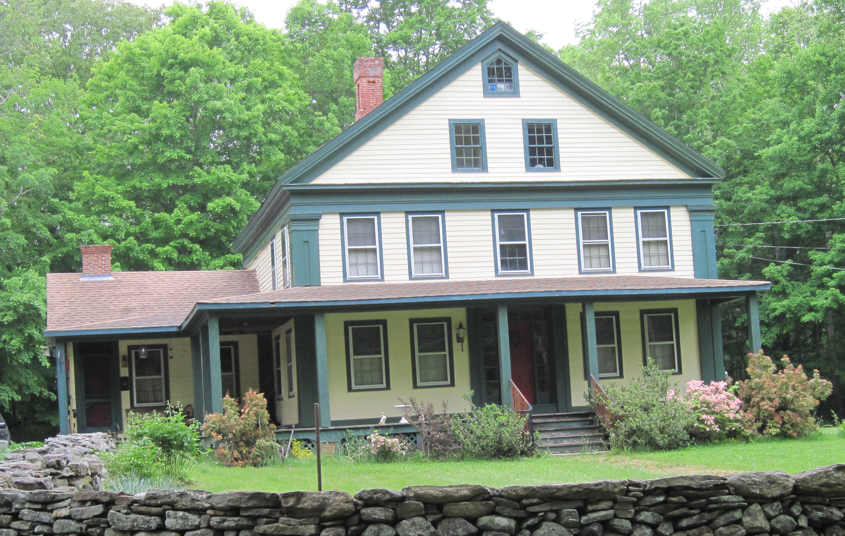
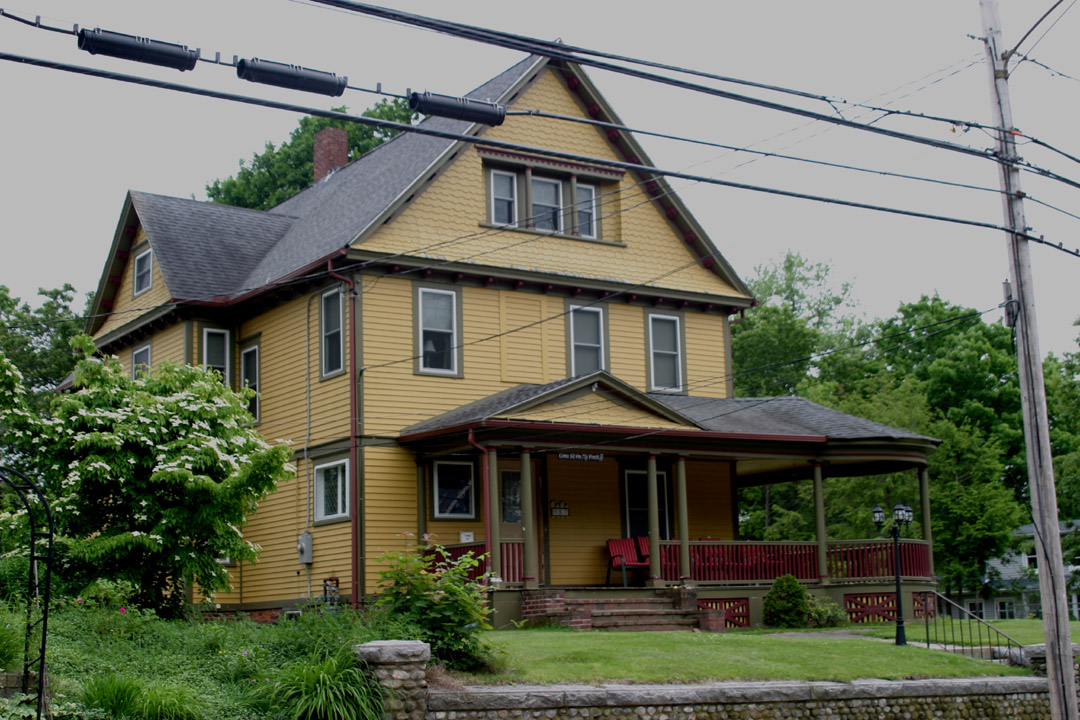
I’m talking about a grand space, the width of the house, better if wrapped around a corner, covered with a roof and big enough to hold a few rockers, maybe a couch and even a swing.

It’s a sturdy, roomy transition from inside to outside, and just close enough to the sidewalk that you can chat with passersby and they can feel it’s OK to maybe slow down and visit, or maybe even sit down for a spell.

And the best ones are at a slightly higher elevation than the street, where the view from a rocking chair is better and the cars and other vehicles look less menacing.

In short, the kind of porch that stupidly went out of fashion for a while in the US.   Can you believe it?

Yes, beginning in the 1840’s, the good old fashioned American porch reigned supreme for 100 years. They were a respite from the heat of the inside of the house, a safe social bridge or shared space between outside and inside for family, friends and acquaintances and a link to nature. Architects of the day loved them. They were the TV room or family room of the time. A link between the private inside and the public outside, they played a huge role in community building, offering neighbors a good opportunity to see and be seen and get to know one another.

But after World War II the porch went out of fashion. We simply stopped building them.

In the mid-1950's my family moved to this post-war home near Kankakee, IL. Note the postage-stamp from stoop, There was a patio at the back of the house.

In the mid-1950’s my family moved to this post-war home near Kankakee, IL. Note the postage-stamp front stoop, There was a patio at the back of the house.

The wide, welcoming platform that was our link between the outside world and the inside world had no place in architecture anymore. Automobiles and suburbanization took hold. People rarely walked anymore. There weren’t even sidewalks in some areas. Air conditioning and television pulled folks inside and kept them there. Those who wanted outdoor spaces settled for ‘patios,’ nearly always at the back of the house.

Many of our postwar houses even allowed us to drive into the garage and go into the house without even using the front door. By and large we stopped getting to know our neighbors. Yes, we waved maybe, chatted over the fence perhaps and in some instances took it further, but that handy outdoor space, the porch, where we could invite someone you might not know all that well to come sit without actually inviting them inside, was gone.  That was an important social lubricant. Having a porch meant you could invite someone to come sit without feeling you’ve been too forward, as bringing them inside might appear, and the other person, in the same fashion, could feel more comfortable in that outdoor space than they might feel inside the house.

Along about the 1980’s, fortunately, things began to change. We began to realize just how important those front porches were to our society and they started sprouting up here and there. The idea of building walkable cities sprang up too. The New Urbanism movement in architecture favored porches and some new, planned communities, Seaside, Florida, for one, actually required them.

in 2012 I rented this house at Coventry Lake in Connecticut. That was a great porch. It was within speaking distance of the one-lane road in front of it and one could look over the tops of the houses across the street and see the lake view. I lived there when I was reconstructing my Mississippi River trip and it was a great place to work.

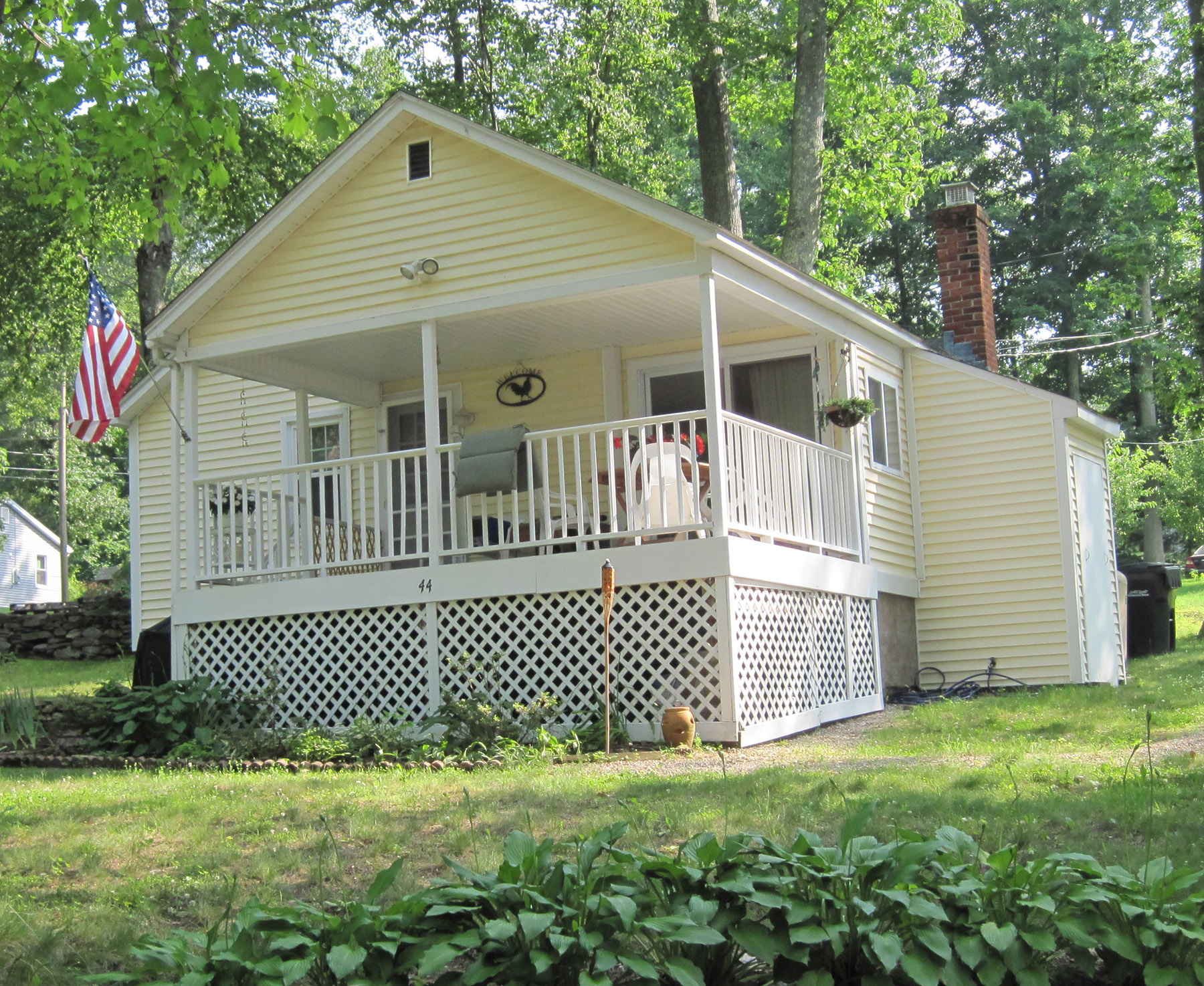
In 2012 I rented this house at Coventry Lake in Connecticut. That was a great porch. It was within speaking distance of the one-lane road in front of it and one could look over the tops of the houses across the street and see the lake. I lived there when I was reconstructing my Mississippi River trip and it was a great place to work.

I am happy to see porches making a comeback. Census data show that nearly two-thirds of new homes built in 2011 had porches, an upward trend that’s been going on since the early ‘90’s.

Meanwhile, I will continue roaming through towns large and small, eying the porches they offer.

When I see a really good one, this thought is always at the forefront:  “I’d like to sit there one afternoon.”

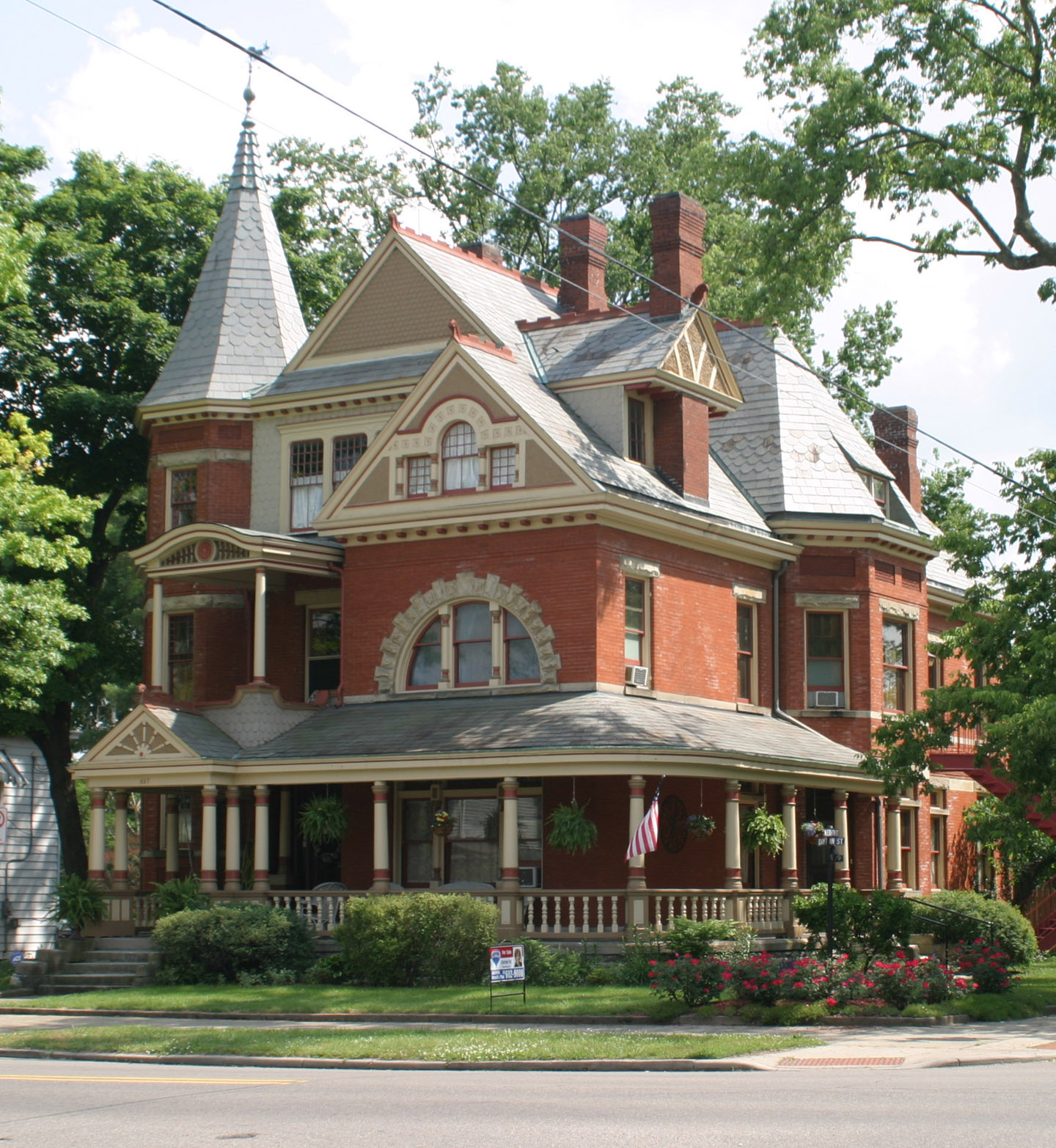
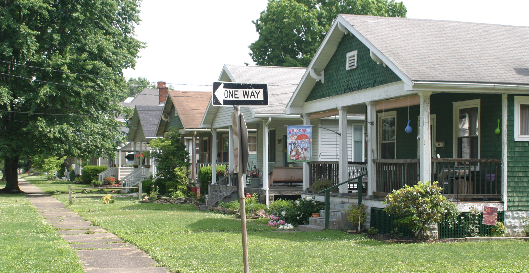
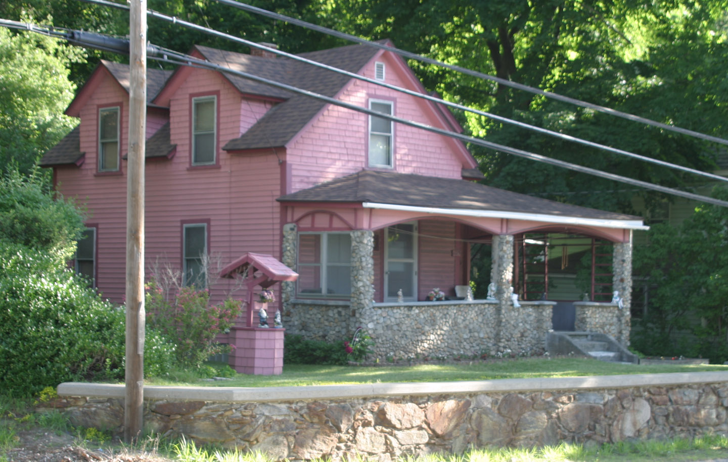
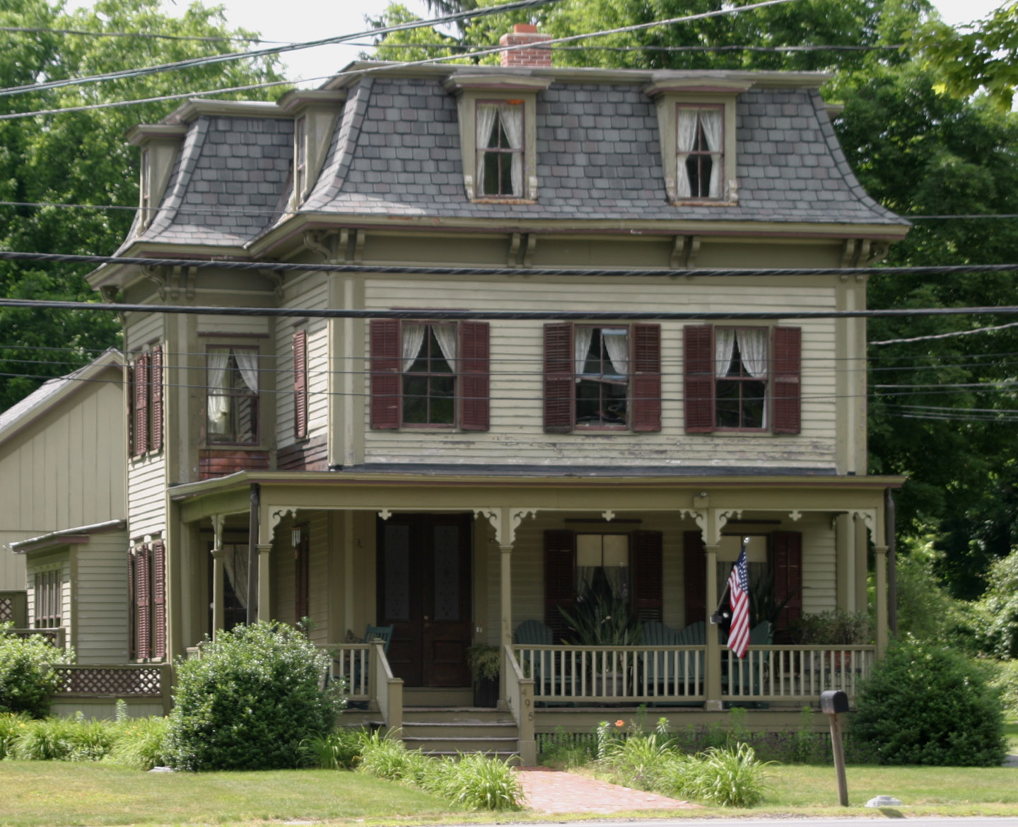
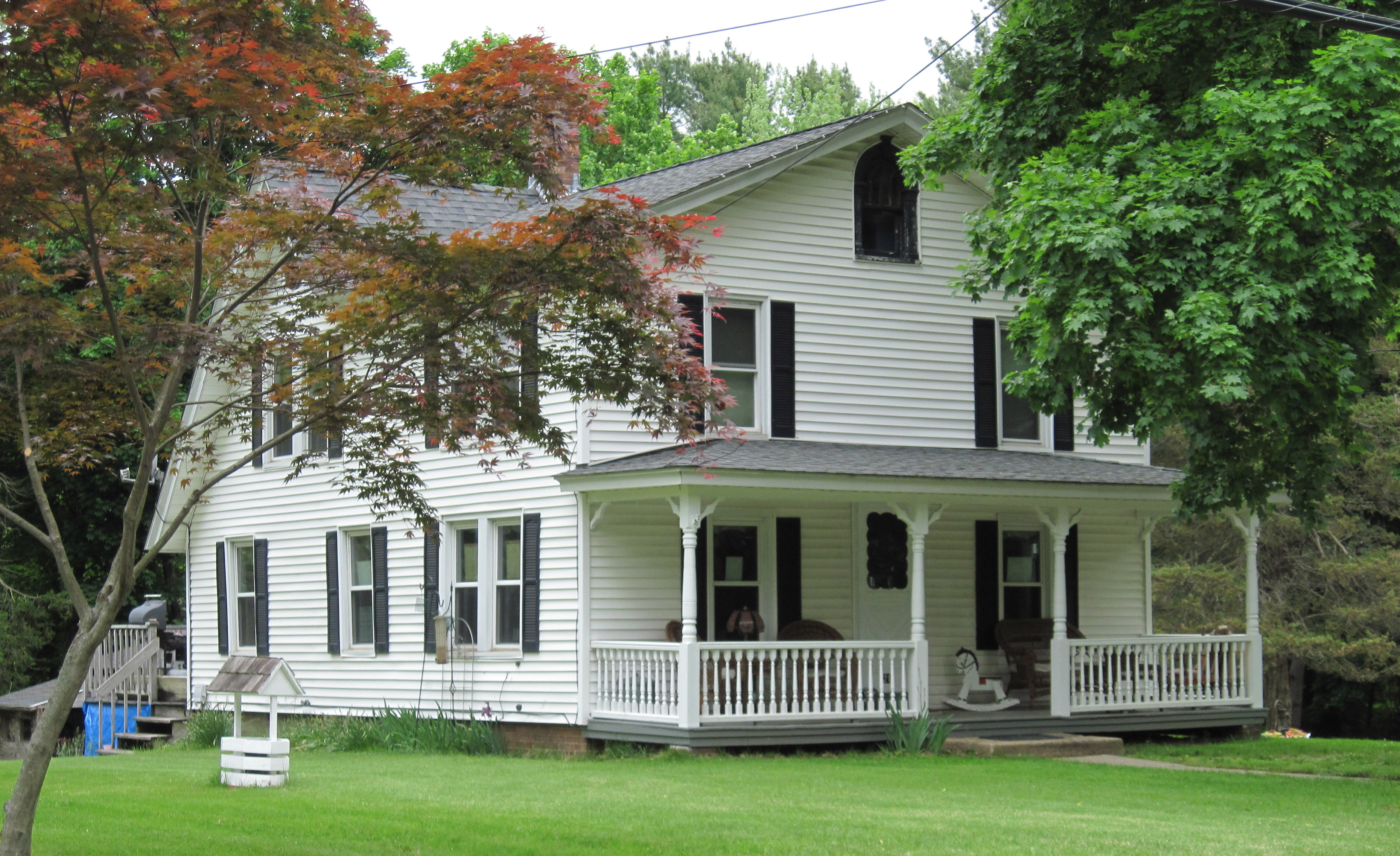
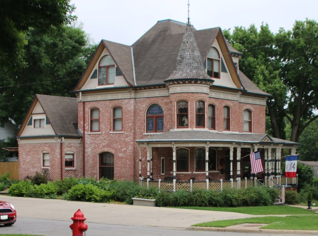
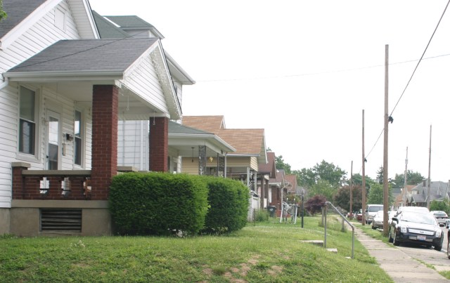
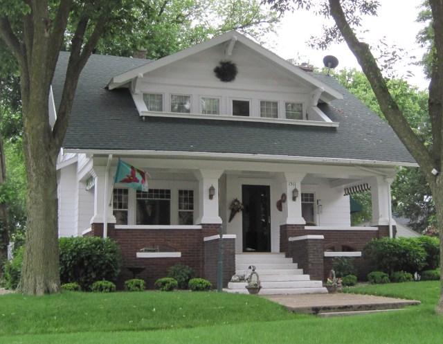
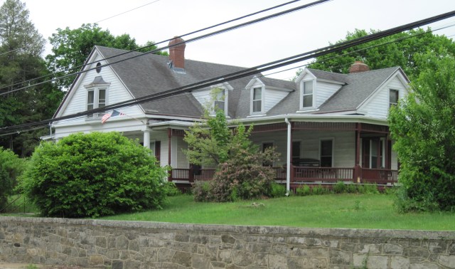
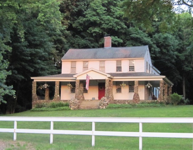
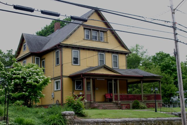
Below are some of the nicer ones I’ve encountered.

Denison, IA Hamilton, OH Hamilton, OH Belpre, OH Oakland, MD Denison, IAIMG_0474c IMG_0478c IMG_0572c IMG_4123c IMG_4384c IMG_4431c IMG_0477c


And finally there is this,  from Garrison Keilor’s “Lake Wobegon Days:”

Porch society is described by Gaylord Gibbon in his Etiquette Along the Mississippi (p.28), a book not found in our house but it applied to us anyway.

The backyard is for privacy. Only people walking in the alley will bother you, and they’re the sort who would anyway. The porch is sociable, but certain rules apply:

* Even if you’re screened from public view, it’s polite to call out hello to passers-by you know. It’s up to them to stop or not. It’s up to you to invite them in or not. The porch is a room of your house, not part of the yard. Only peddlers or certain ministers would barge right in.

* If you say, “Why don’t you come up and sit for a bit?,” it is customary for them to decline politely. If the invite was legit, it should then be repeated.

* An invite to the porch is not an invite to the house. Its terms are limited to a brief visit on the porch, no refreshments necessarily provided unless the occupants have such at hand.

* When the host stands and stretches or says, “Well-,” the visitor should need no further signal that the visit has ended. Only an oaf would remain longer. If the host say, “You don’t have to run, do you?,” this is not a question but a pleasantry.

Posted in Offbeat, Road trip | 6 Comments

The eagle has landed

Just west of Hebron along Route 66 in Connecticut is a rock that really sticks out. Painted to resemble a bald eagle, it looms over the road and looks great from either direction.

IMG_0728cIt wasn’t always an eagle. It has been at times a frog, whale, turtle and even a shark, according to local lore. I think it would make a great snake head too, which is actually what I thought it was meant to be when I saw it the first time.

It became an eagle in 1989 when a senior from the nearby high school came up with the concept and made it happen. Through the years, with the help of folks who’ve taken on the maintenance task, it has remained an eagle. One account says the painter is now a New York artist and another has him living in Virginia. I think the New York artist version makes the better story, so I will go with that.

And, in case you’re wondering, Route 66 in Connecticut is a state route and has nothing to do with the famed US Route 66, which ran from Chicago to Los Angeles.

A couple other views of our eagle: IMG_0735c IMG_0716c

And just for fun here are a couple of REAL eagles I’ve seen this year, and a photo of me with one:highres_442436270.jpegC IMG_0701c eagle4c

Posted in Offbeat, Road trip | Leave a comment

Maine’s only curling club?

I guess I’m getting to be an old hand at ferreting out curling clubs on my meanderings around the northeast.

IMG_0536cThe symbol on this sign was instantly recognizable as I drove along Route 3 in Belfast Maine. Very similar to this one I’d seen in Petersham, MA, last year.

According to its website, the Belfast Curling Club claims to be the only one in Maine, but in truth, there is one over in Portland, the Pine Tree Curling Club.

Purists, however, would argue that the facility is Belfast is a true club, boasting its own, three-sheet facility (and all the various ‘speils’ that are part of the curling tradition), while the group in Portland is a mere arena curling club, using shared ice at a public ice arena, in this instance the William Troubh Ice Arena.

One huge difference in the two concepts appears to be administrative ease. The folks in Belfast are in the midst of a huge fund-raising drive for major renovations, while the group in Portland is full-up and accepting newcomers for a ‘substitutes’ list, all ready to train members how to get ice ready for curling.

See this Smithsonian article for way more than you want to know about all that.

IMG_0540c

Posted in Offbeat, Road trip, Signs | 3 Comments

Another recycled gas station

Here’s another old gas station with a new purpose.  It’s in Bloomfield, CT, and it’s a restaurant called The Filling Station.  For my full collection of recycled gas stations from across the country, go here.

Posted in Gas stations, Road trip | Leave a comment

Johnny Cash at the bottom

If it weren’t for driving by this sign on my recent trip to California, there is a lot about Johnny Cash I probably wouldn’t know.IMG_2213cSeeing the sign prompted me to find out when he lived there and it was then that I discovered that it was basically the start of a pretty dark period of his life, a period I guess I figured must have existed, at least in the songs, if not in real life.  But it was real life and it was deeper and longer than what I had assumed.

On the heels of success with such hits as “I Walk the Line” and “Folsom Prison Blues,” the 26-year-old moved to California in 1958 with his eye on Hollywood stardom. He bought Johnny Carson’s old home in Encino and for three years all went well.

It didn’t last. With his dreamed-of movie career in a shambles, a drug habit starting, and marital life tense, he sought to make a new start in 1961 with a move to Casitas Springs with then-wife Vivian and his three daughters. The hilly, arid farming community is some 75 miles up the coast from Los Angeles.

That didn’t work. He spent months away from home, avoiding confrontation. He took up with various women, including June Carter, who joined his touring group in 1962. His marriage finally ended in 1967.

This Los Angeles Times article sums it up: “One of the most vivid childhood memories of Cash’s two oldest daughters, Rosanne and Kathy, was watching their mother, Vivian, puffing anxiously on a cigarette as she stared through the living room window of their Casitas Springs home on those rare nights when she thought her husband might actually be coming home. Vivian imagined him in the arms of June Carter, or dead somewhere of a drug overdose, and she prayed to see the headlights in the driveway that would prove her wrong. On most nights, Vivian gave up around 1 a.m. and tried to grab a few hours sleep before getting the girls ready for class at St. Catherine-by-the-Sea elementary school.”

Or, as Ojai Life more succinctly puts it: “In 1961, the country star built his dream house in Casitas Springs. Then he spiraled out of control.”

The ensuing years, extending into the 1990’s, were full of drugs, fights, overdoses, car crashes, a controversial forest fire, even boycotts from a white supremacist group, and finally, redemption. At one point, guitarist Luther Perkins advised Cash’s minders that whenever the star was on the ropes: “Let him sleep for 24 hours. If he wakes up, he’s alive, if he doesn’t, he’s dead.”

His life, in short, became a country song. If you’re interested in all the details, try “Johnny Cash — The Life,” by Robert Hilburn.

Posted in Road trip | Leave a comment

A new fashioned breakfast in an old fashioned building

I combined a couple of favorite pleasures one morning on my recent visit to California: Breakfast with an old friend and a look at a classic old gas station building that’s been recycled into a bakery and restaurant.

My companion was Mary Ann Norbom, for those from the publishing world who may be reading this.

And the establishment was Bob’s Well Bread Bakery in Los Alamos, CA, a small bump in Route 101 about two hours up the coast by car and light years away by temperament from Los Angeles.

But it was still California, and the proprietor a former resident of Gollywood, so the fare was not the two eggs over easy with bacon, home fries and toast that I usually order.

The menu is below. I had the Eggs-in-a-Frame #2. It was delicious. I still don’t know what all the words mean.

And in case you haven’t looked lately, there are lots of new photos of recycled gas stations in my collection.  Go here to see them.

IMG_2219menuIMG_2222c

Posted in Gas stations, Offbeat, Road trip | 3 Comments