New Hampshire’s answer to Wisconsin’s brats and beer I guess. Locations in Keene and Jaffrey (in photo).
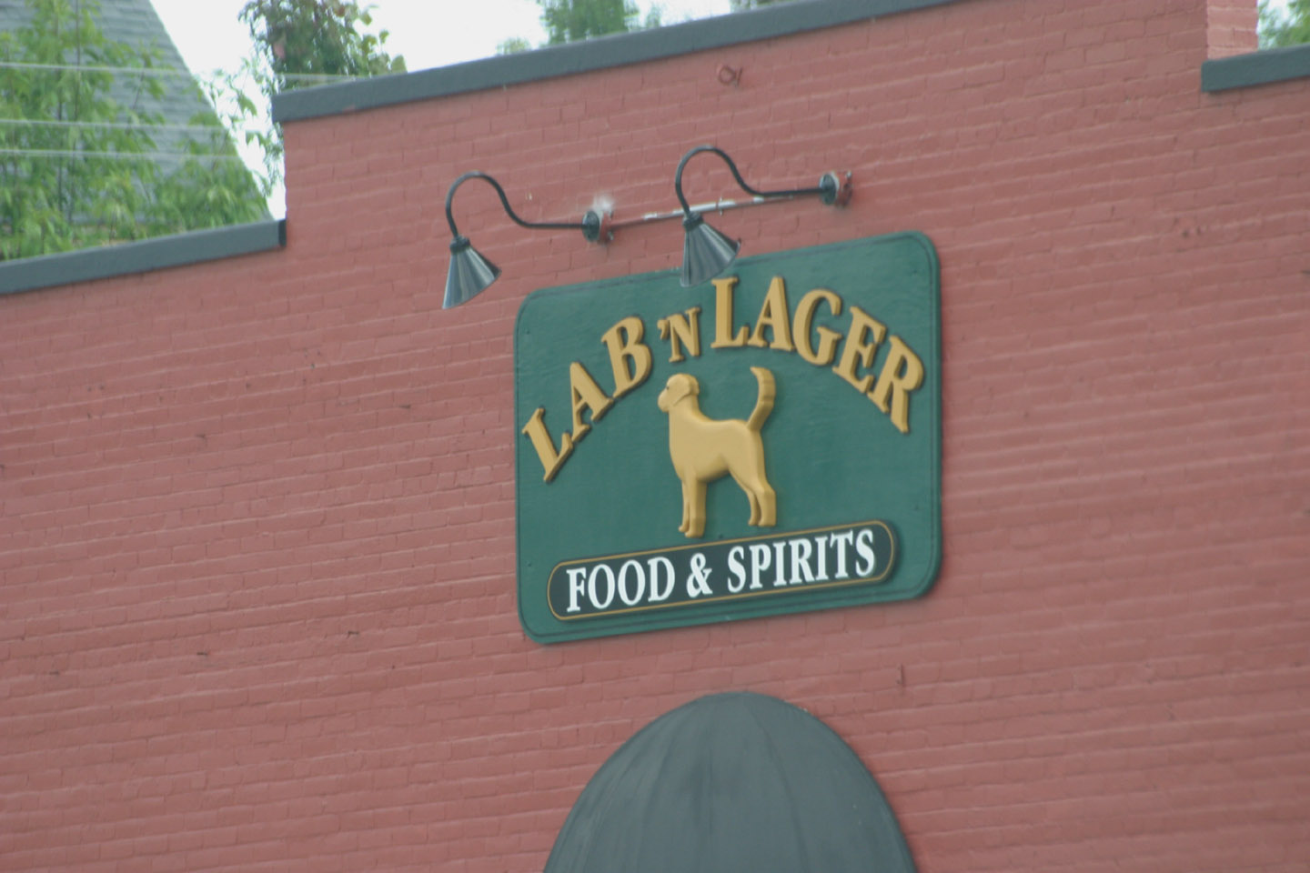
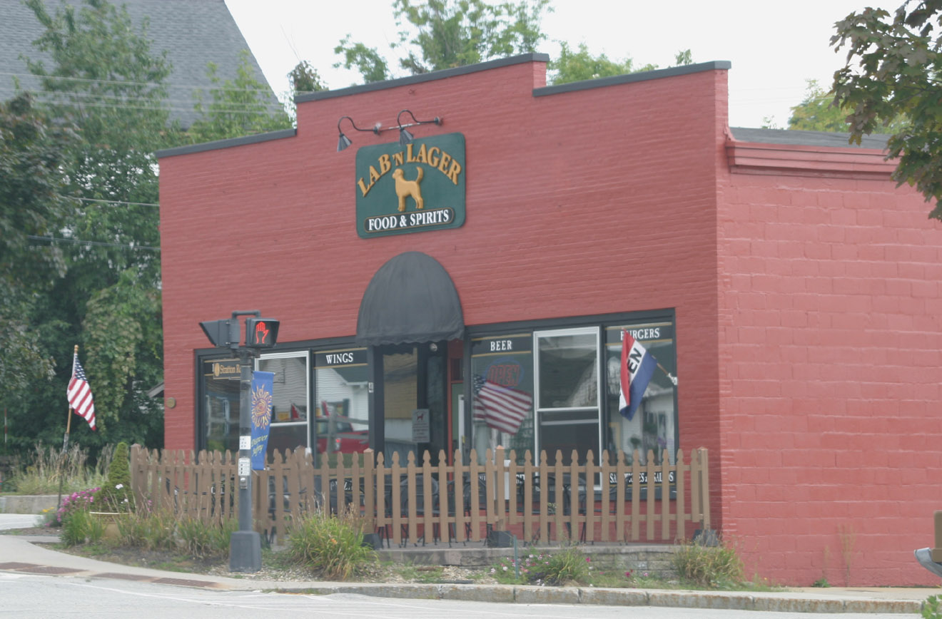
New Hampshire’s answer to Wisconsin’s brats and beer I guess. Locations in Keene and Jaffrey (in photo).

Sometimes another man’s trash is my treasure. Other days it’s just trash. Today was one of those days.
It was the first Saturday of the month and I was in New Hampshire once again for a Trash Patrol, organized by Denise Hurt, a paddling leader in the Appalachian Mountain Club’s New Hampshire Chapter. She started these paddles in 2013 and they’ve been a resounding success.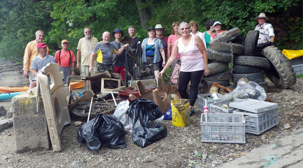
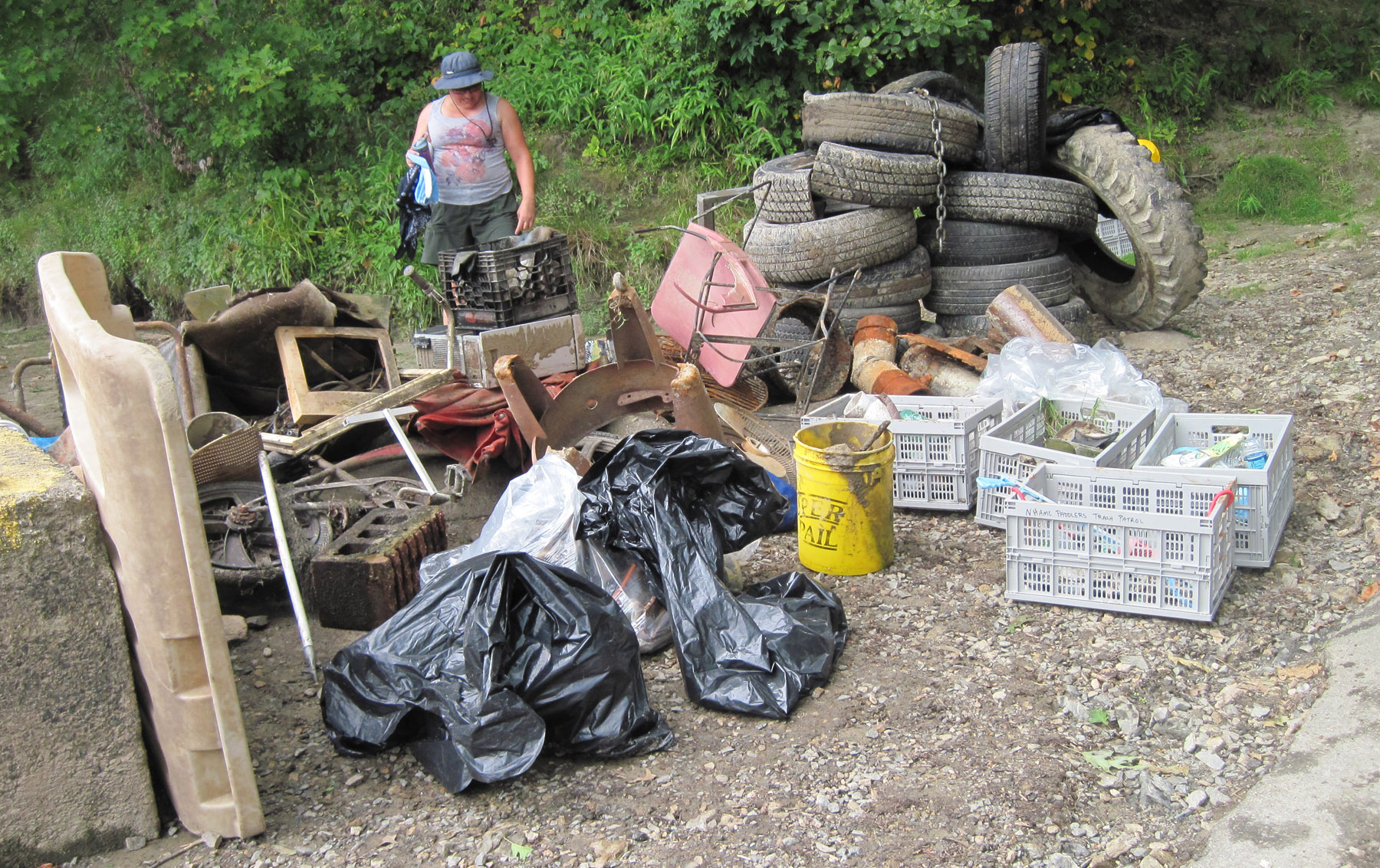
Above, group shot with the pile of trash we picked up. I am third from left in back row. Below, still life of the trash.
 Denise is a great organizer, ready every time with crates to tie to the top of the kayaks, grabbers to pick up things, gloves, water, plastic bags, and, this month, lunch provided by Subway!
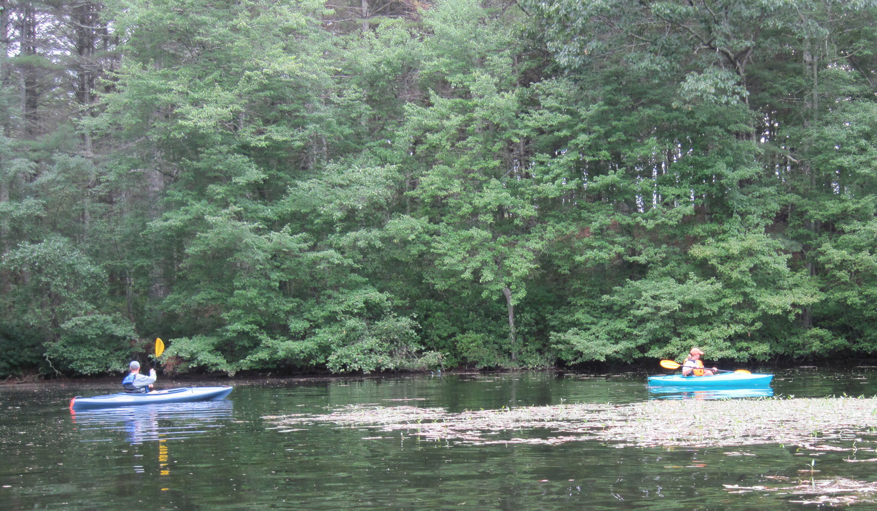
We were on the Merrimack River off Greeley Park in Nashua. The water level was low, and the trash was plentiful and right there in plain sight, as the photos below show.
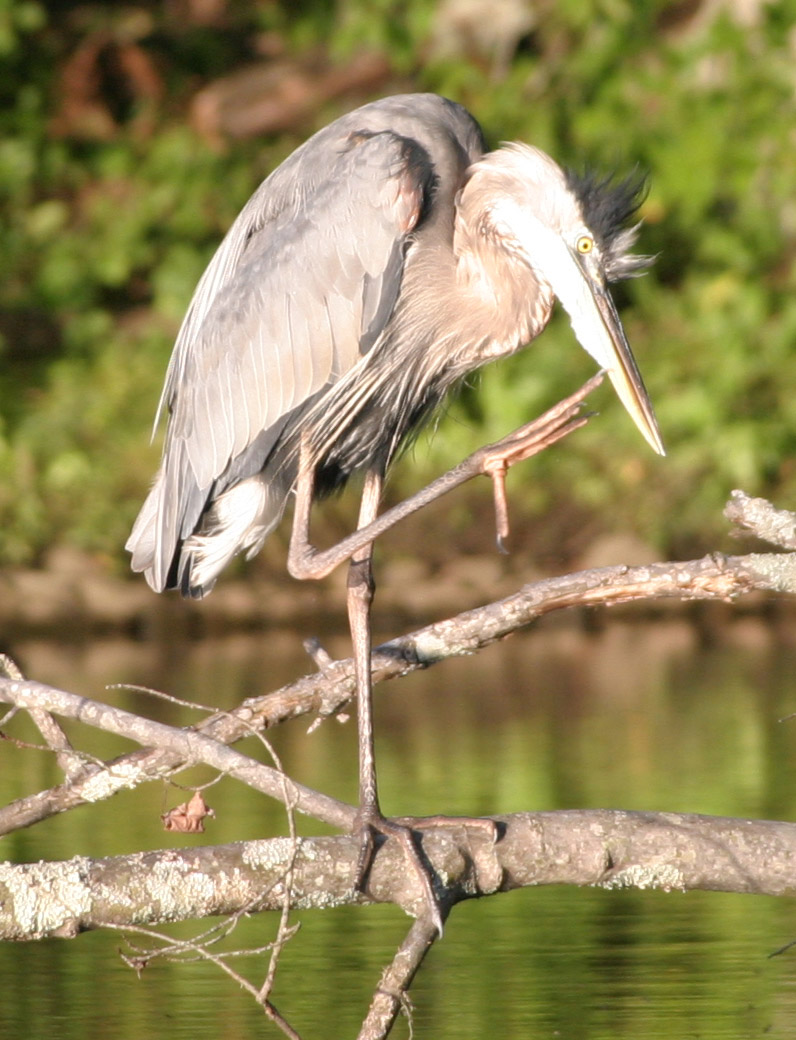
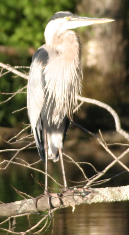
I’ll let Denise report: “We collected a record 13 tires, a couple tire rims, 3 chairs, 2 computers, a bicycle, large insulators, the side off of a piece of play yard equipment, a window frame, several sheets of glass, the grill from a BBQ, a patio umbrella, ceramic pipes, 160 assorted trash items, 110 recyclables, and a beaver skull! All this in approximately 2 miles of river! The Great Blue Heron sighting was a value added event!”
I could go on and on about the stupidity of people who throw trash in our waterways, but I’d be preaching to the choir I am sure, especially those of you who participated in the Sierra Club’s annual Loxahatchee River cleanup trips in the 1980’s in Florida.
Speaking of such, for laughs I have thrown in a 1988 newspaper clipping of my daughter on one of those trips. My head is creepily visible in the center of the photo. I was waiting in the canoe while she scoured the bank on foot. It must have been chilly that day, judging by the way we were dressed. Probably in the 60’s.
To see how a really serious trash paddler does it, don’t forget to see my friend Al’s blog. He wraps history, geography, anthropology and humor around picking up trash and makes it all very interesting.
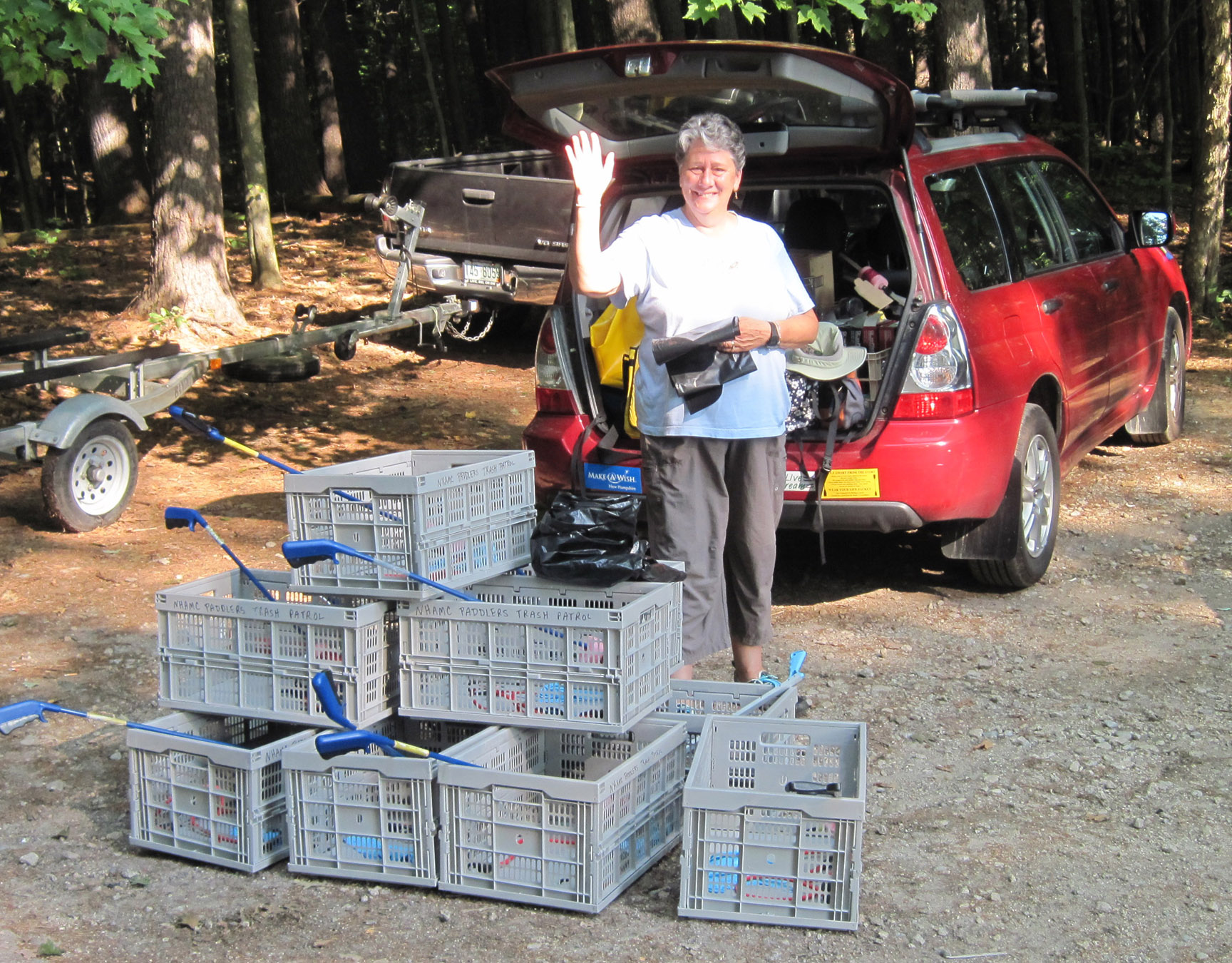
Above, Denise with all the gear needed for a successful clean up trip.
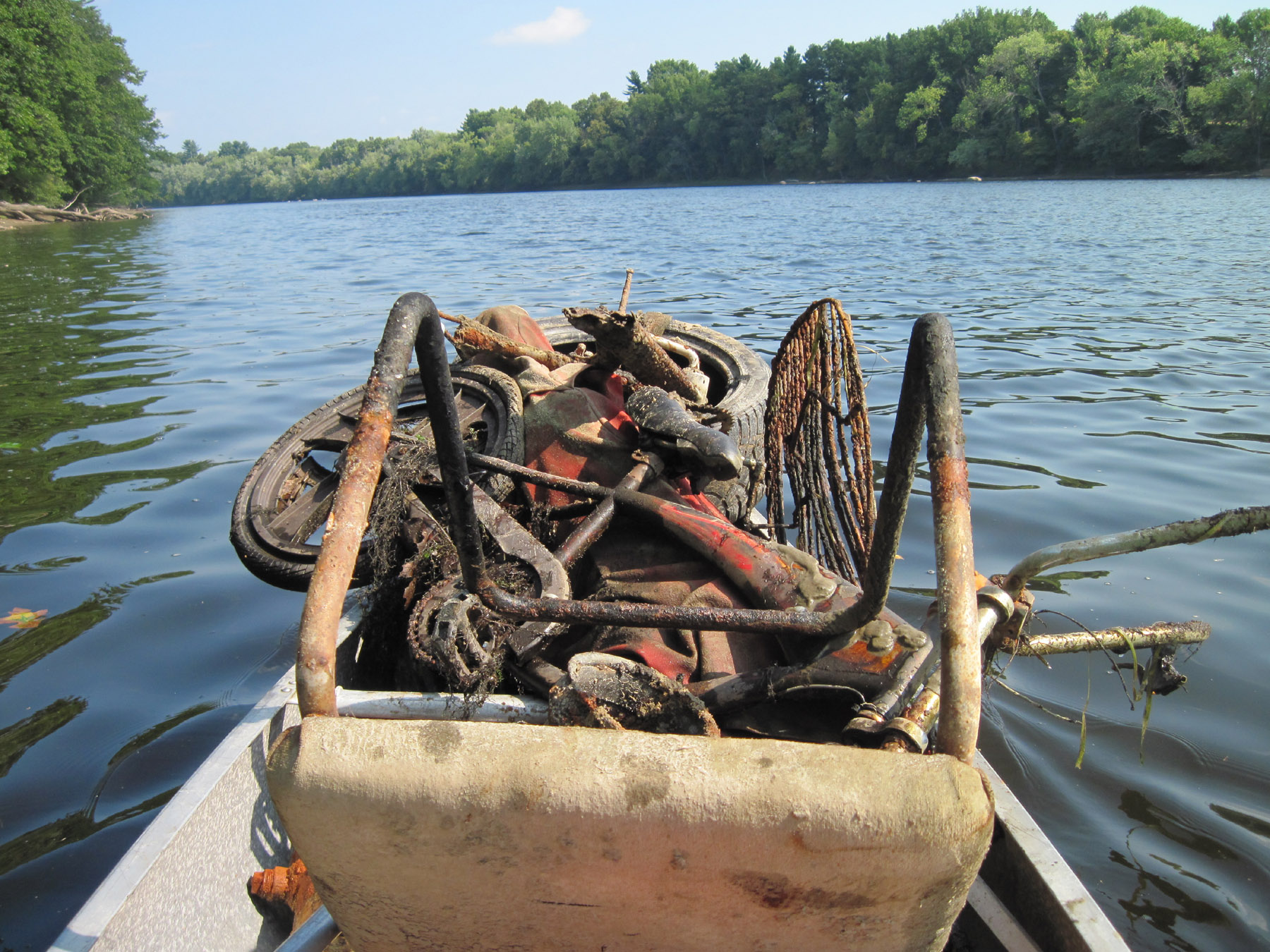
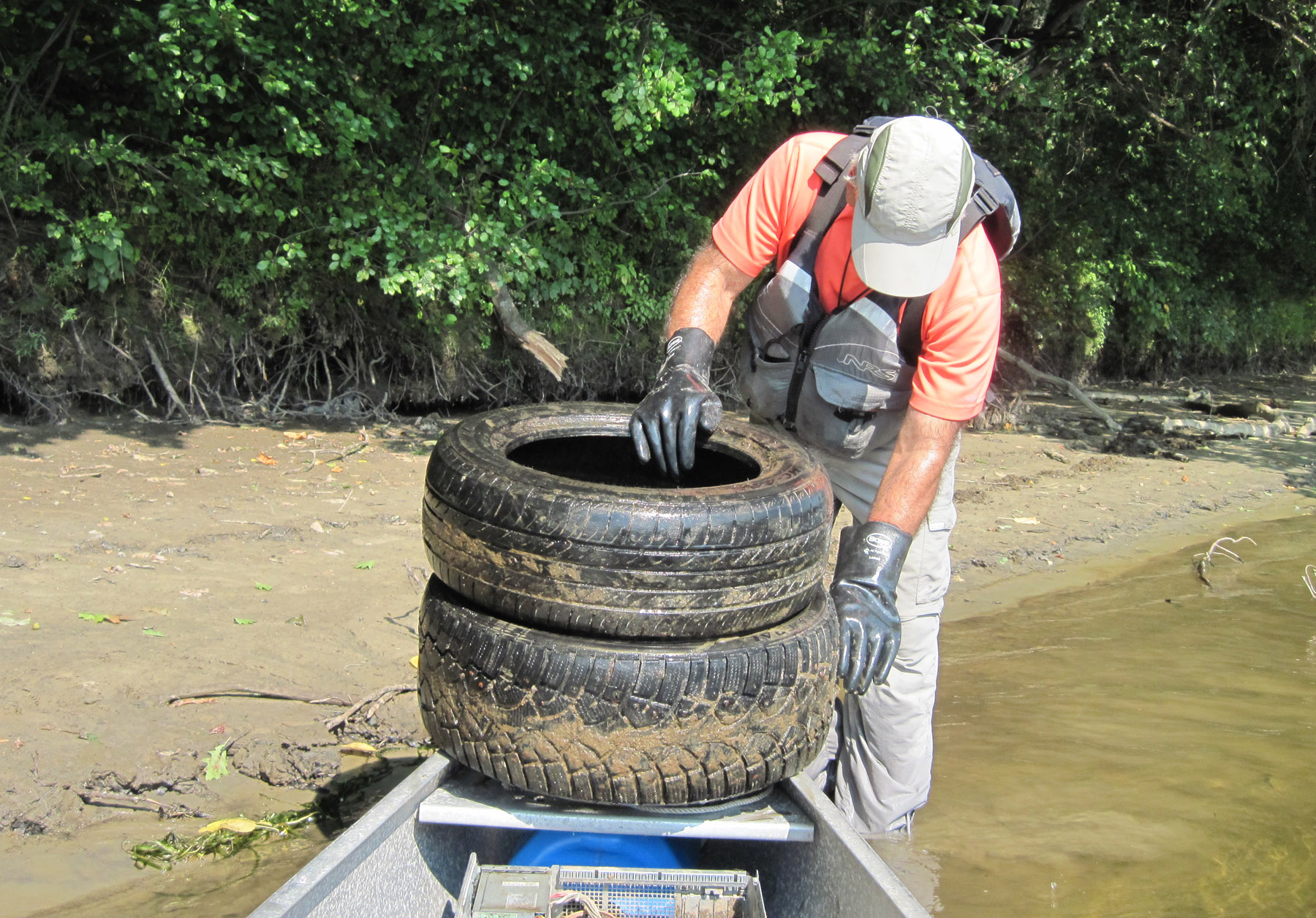
Above, the view from the stern of my canoe. I was headed back to the launch point to empty the boat so I could head back out for more. Below, Al puts some tires in the front of the canoe.
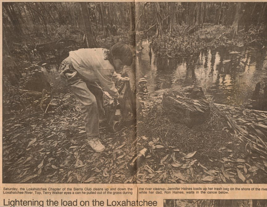
Palm Beach Post, 1988. Article features the Sierra Club cleanup trip down the Loxahatchee River. My daughter fills a bag while I watch from the canoe.

This beaver skull was a treasured find on the trash paddle.

…while I continue with my aimless meandering.


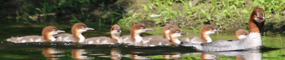
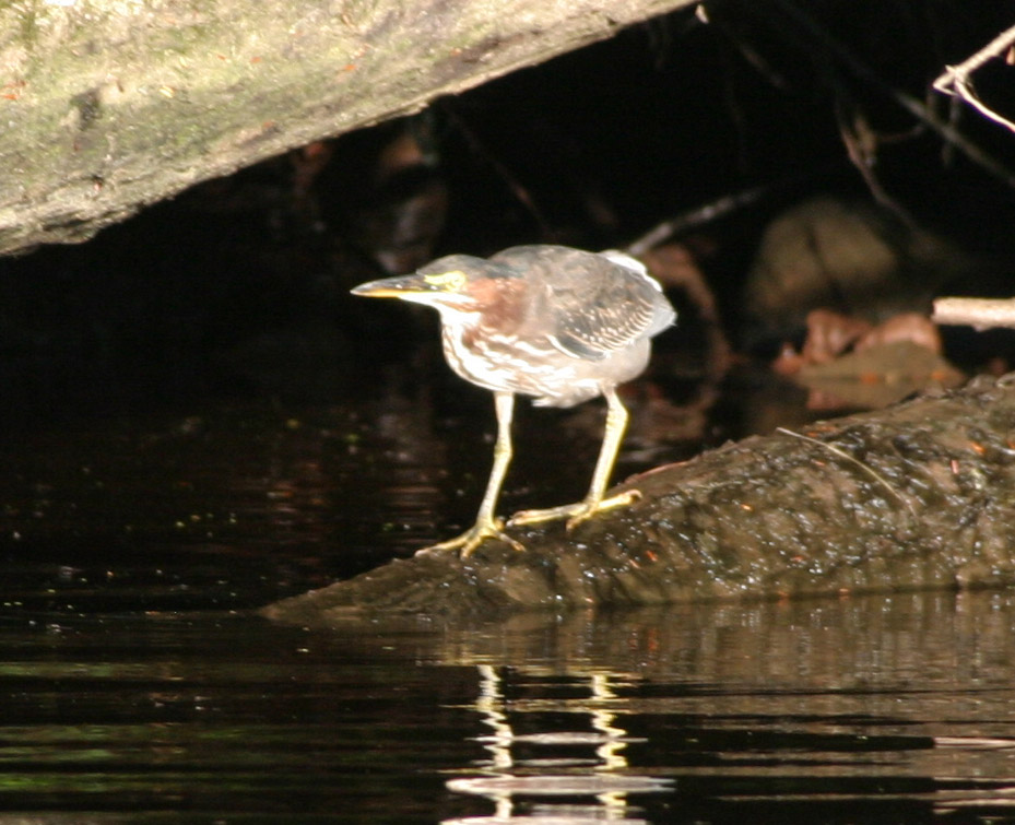
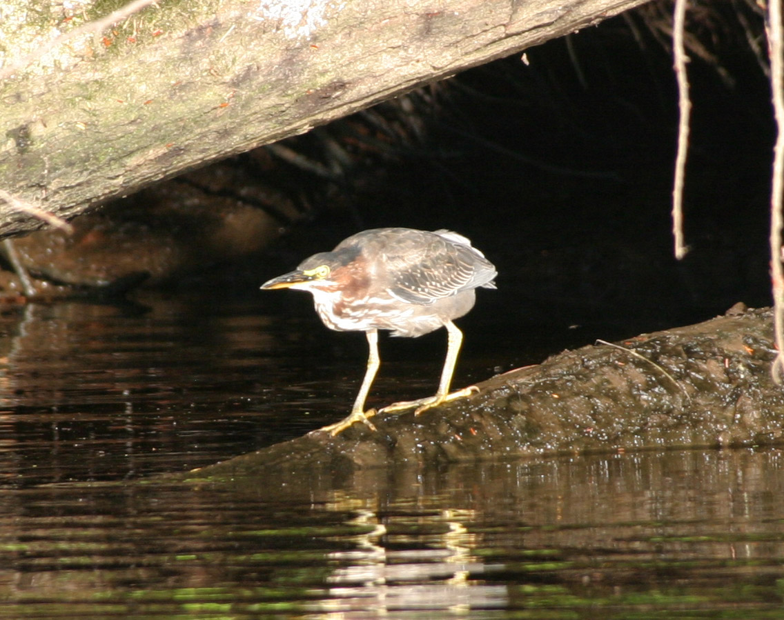
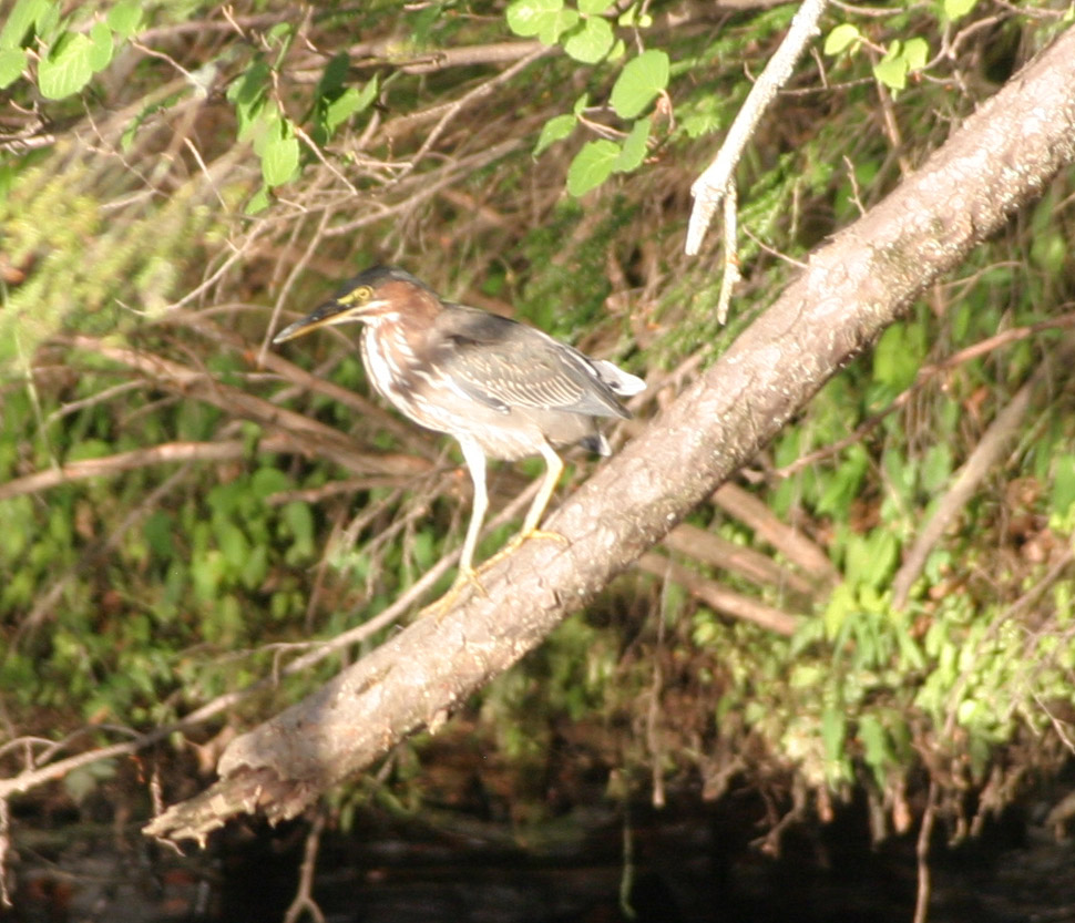
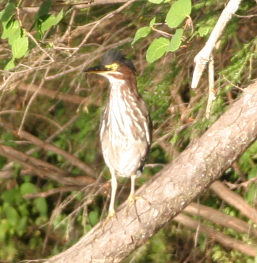
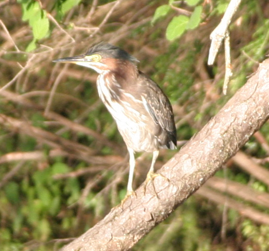
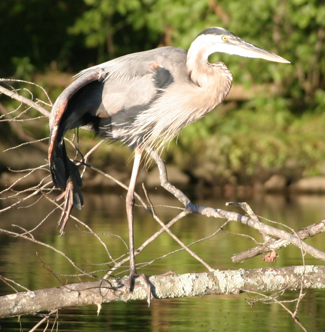
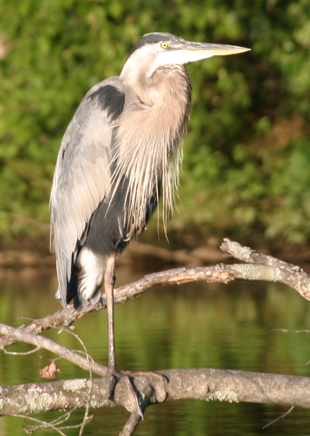
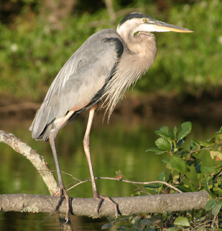
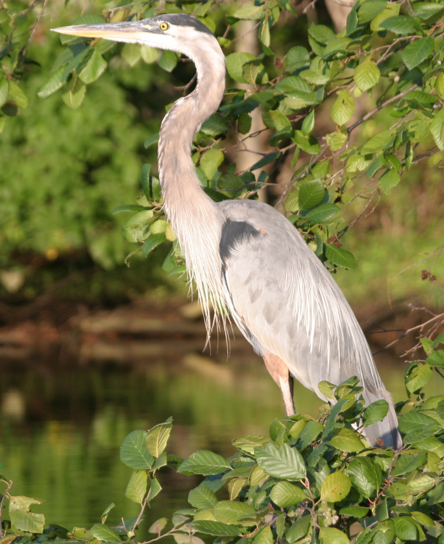
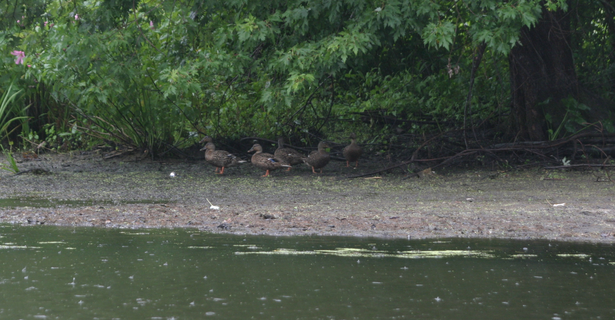
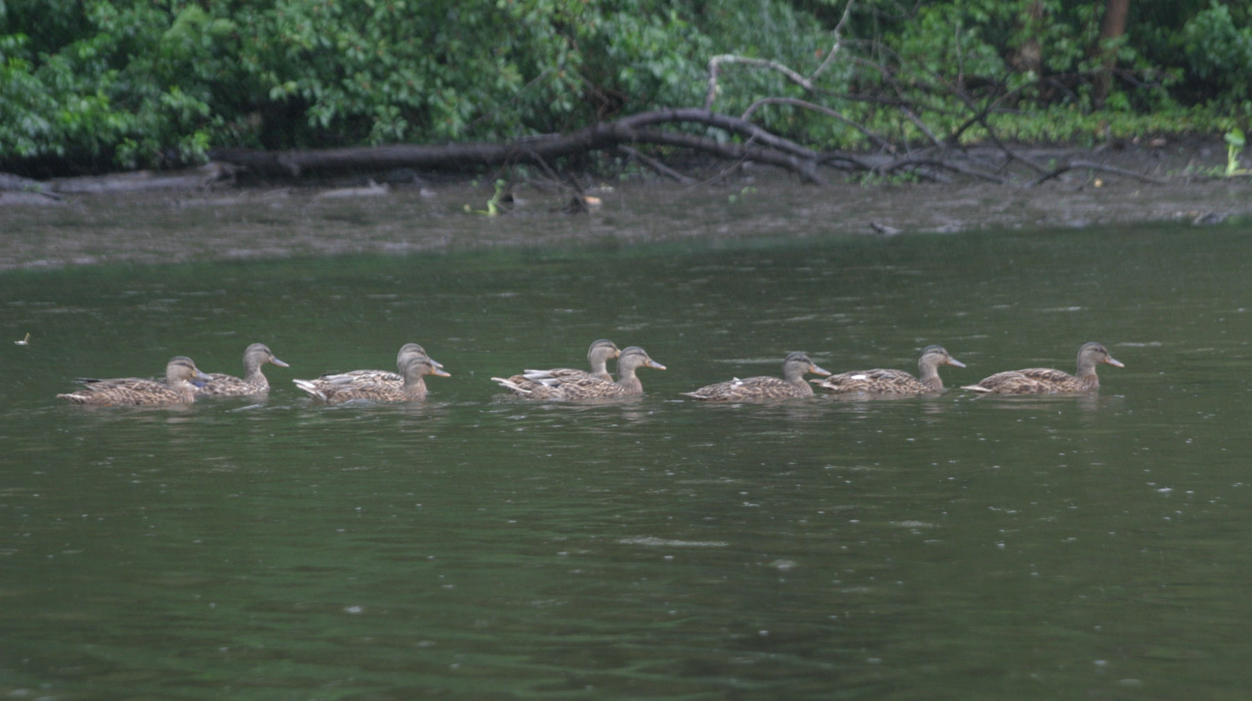
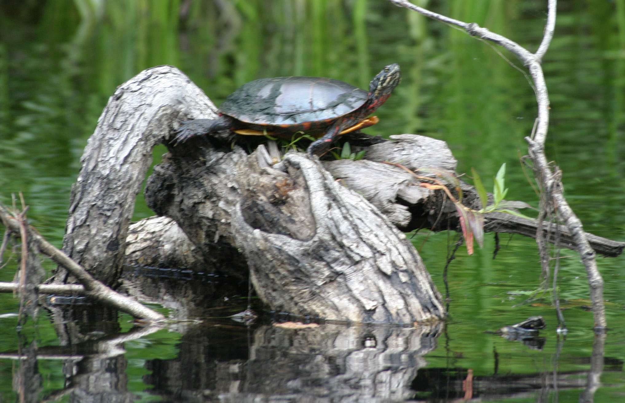
 Spotted today on Lower Bolton Pond, Bolton, CT.
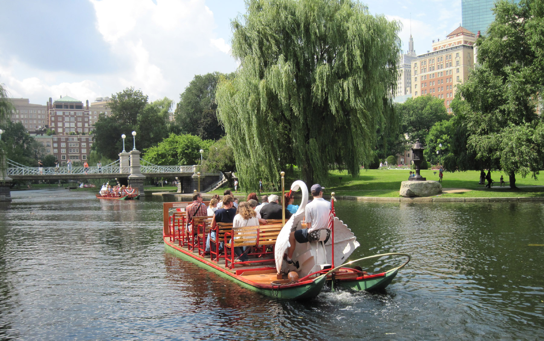
The last time I visited the Boston Public Garden with a four-year-old to view the setting of the book Make Way For Ducklings was with my daughter, Jennifer, and the year was 1984.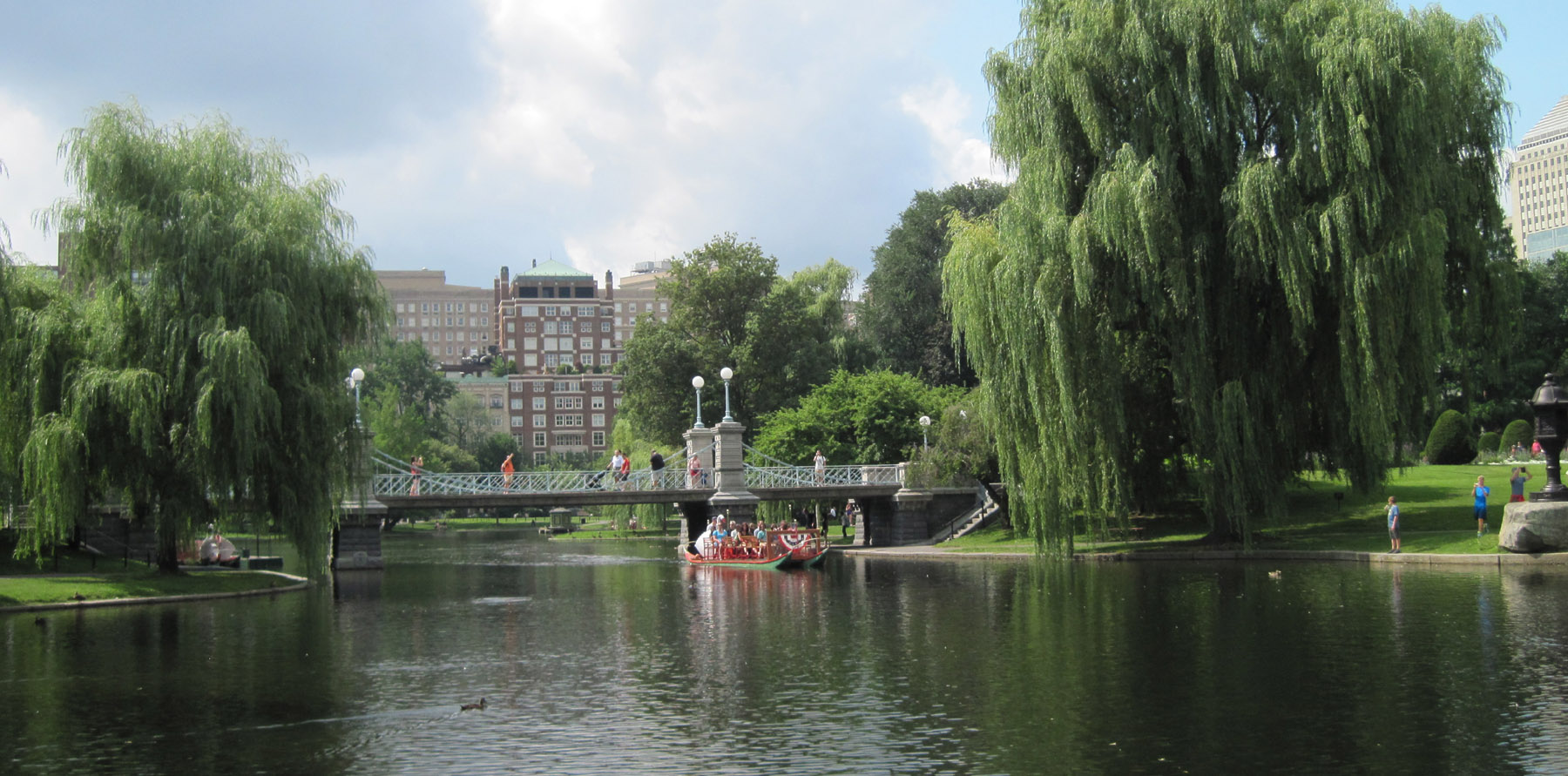 There was a lot of me invested in that trip, as I dimly recall, because I had read that book over and over and over again to her for months. It was her favorite at the time, completely memorized. My parental mind told me she was wildly excited at seeing the real thing. The reality more likely is that I was way more excited about it all than she was. I don’t know if I have any photos from that visit. My memory tells me it went well.
I revisited the Garden this summer, with my daughter and Margeaux, HER four-year-old. For me it was mentally perfunctory by comparison to the original trip. The book, read to Margeaux a few times by her grandma and mother, had only been in the house for a day or so. I hadn’t even read it to her yet myself.
I am happy to report that thirty years later, 73 years since Make Way for Ducklings was first published, it’s all still there, sort of.
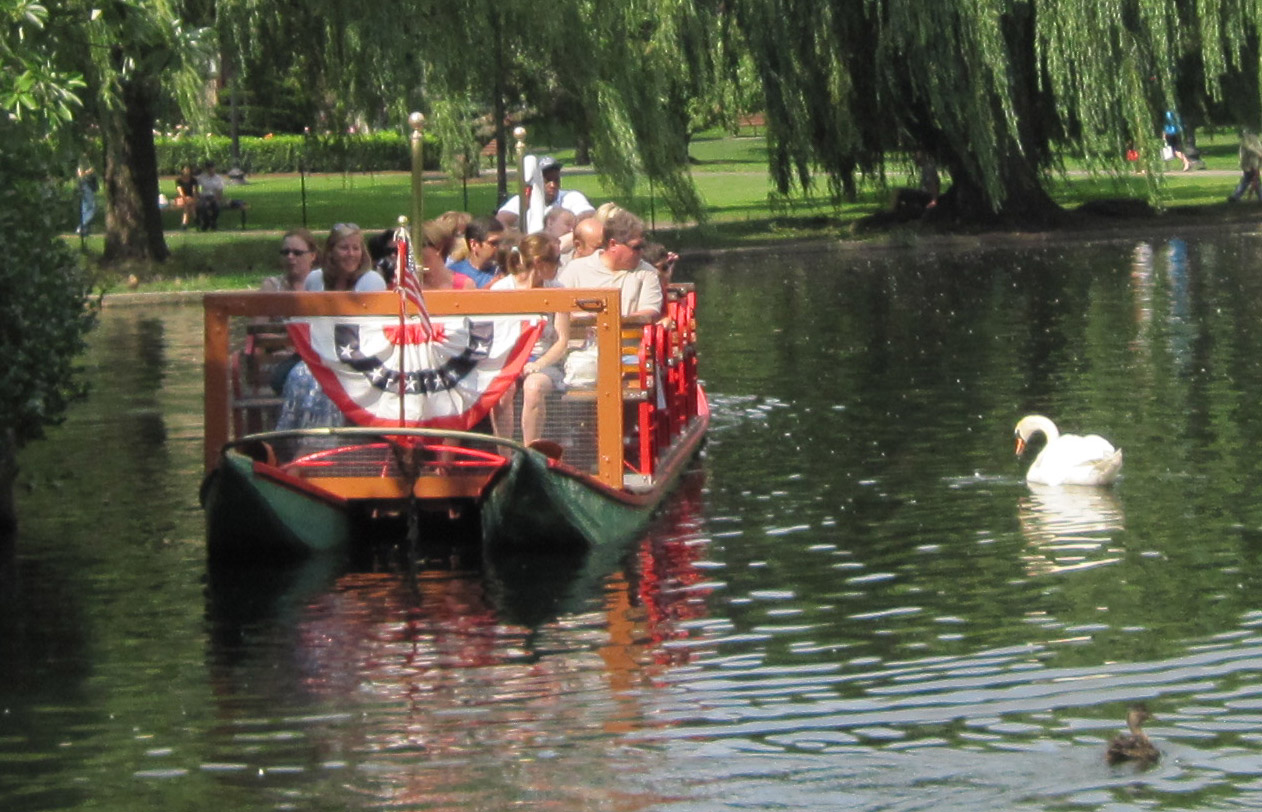
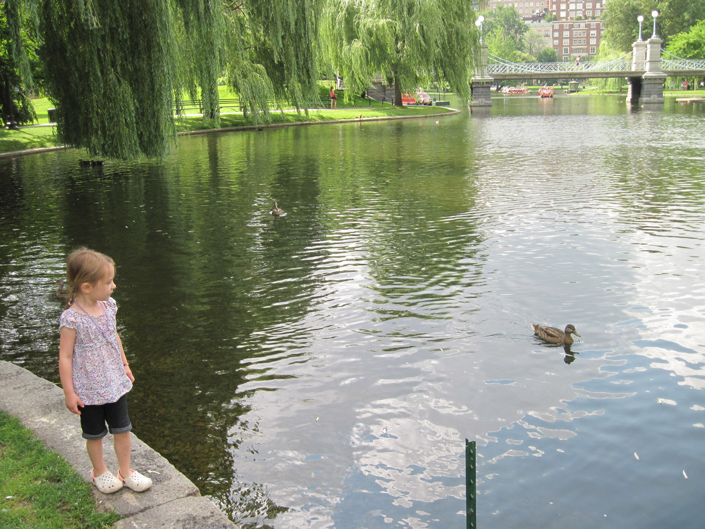
Sure, the swan boats, started in 1877 by Robert Paget and still run by his family, continue to ply the waters regularly. And the island the ducks finally called home is still right there in the lagoon. (And of course the Cheers bar is still there across Beacon Street.) But the duck tracks on the sidewalk tracing the walk up from the Charles River that I recall from my first visit are gone. Taking their place I suppose is the very nice, and terrifically photogenic, Nancy Schon sculpture of the parents and their eight offspring. It’s at the corner of the park they would have entered after the walk up Charles Street. In the photo above, granddaughters Margeaux and Simone are doing what all kids do when they see them. (Cheap way to keep them shiny I guess)
A bit of a mystery, however, are the bicycles that scared the ducks, described in that fearful illustration of spinning wheels and scattering feathers. Biking is prohibited in the Gardens, and the ban seems to be effective, as I saw none there. I can’t remember if it was allowed when I was there before, or even at any time in the past, to explain the mention in the book, so I queried the City of Boston Parks Department. I asked when the ban was instituted and added that use of bicycles there was mentioned, and illustrated, in the book. I was told flatly and humorlessly that bicycles have NEVER been allowed in the Garden, period.
I found no reference to the presence of bikes in the book being a factual error, but did discover that it has been criticized for having a loose plot, as well as poor characterization. Hey, it’s a children’s book, people!
And a pretty good one, I think. (if you know about the bicycles, please share…)


I’ve been flying in and out of Hartford, CT, for a decade now. Oddly enough it all began about the time my daughter moved to Connecticut from Florida.
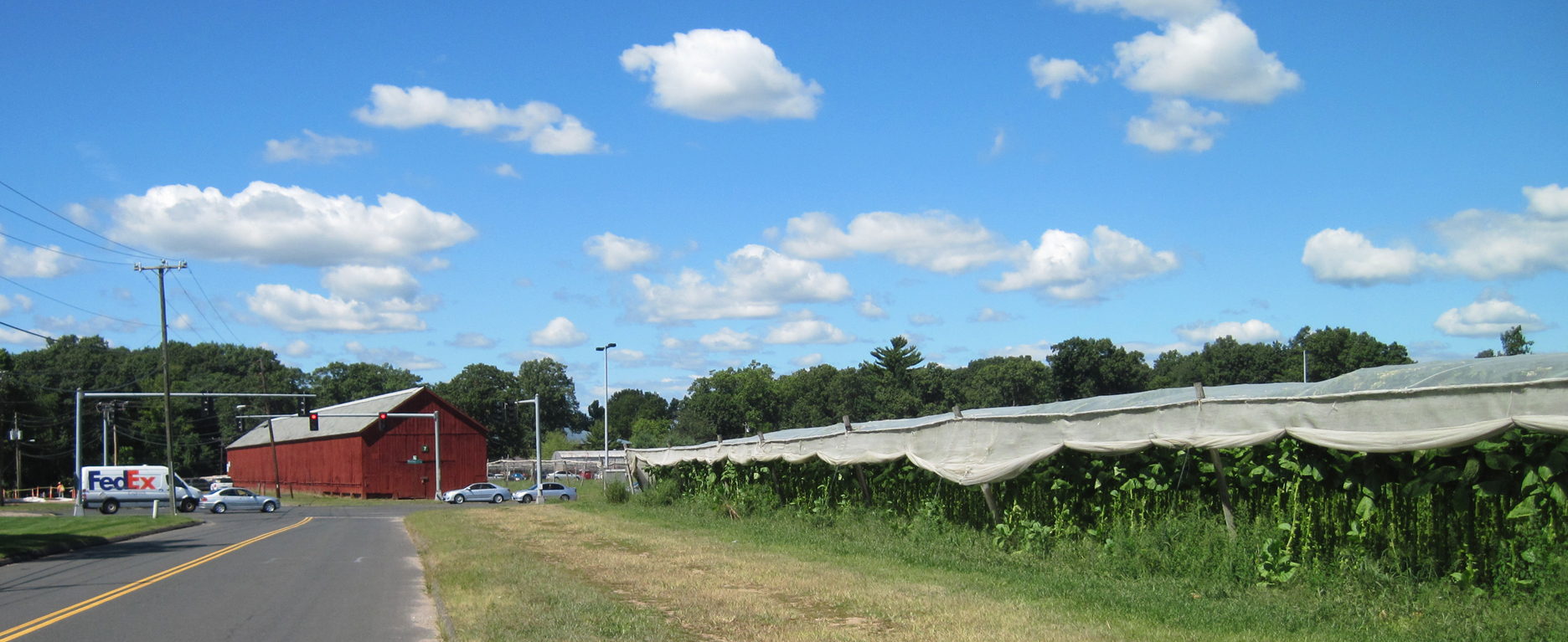
From nearly day one I wondered about the cloth-covered growing fields and big red barns I see when taking off and landing. (The airport, called Bradley International Airport, is actually located in semi-rural Windsor Locks, some 13 miles north of Hartford)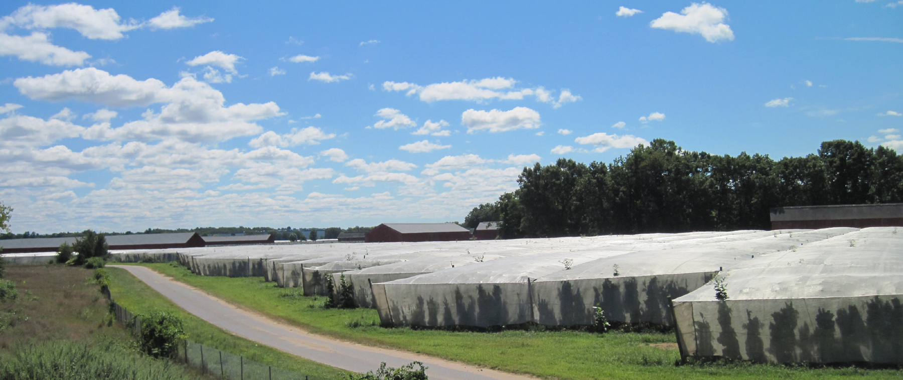 ‘It’s tobacco,’ someone told me, but that never made complete sense. Why would an unlikely region in the Connecticut River valley be growing tobacco on such a seemingly small scale when there surely must be huge fields in the southern US somewhere to feed the smoking habit?
So I finally took the time to hit a few internet buttons and found the answer: Connecticut Shade Tobacco.
It’s used for the two outside layers of cigars, the binder and the wrapper. The crop is grown in the shaded fields and cured in the red barns.
Blessed with desirable ‘Windsor Soil,’ the upper Connecticut River Valley (roughly from Hartford to Springfield, MA) was already being used by the native population to grow tobacco when settlers descended in the 1600’s, and by 1700 the crop was being exported to Europe.
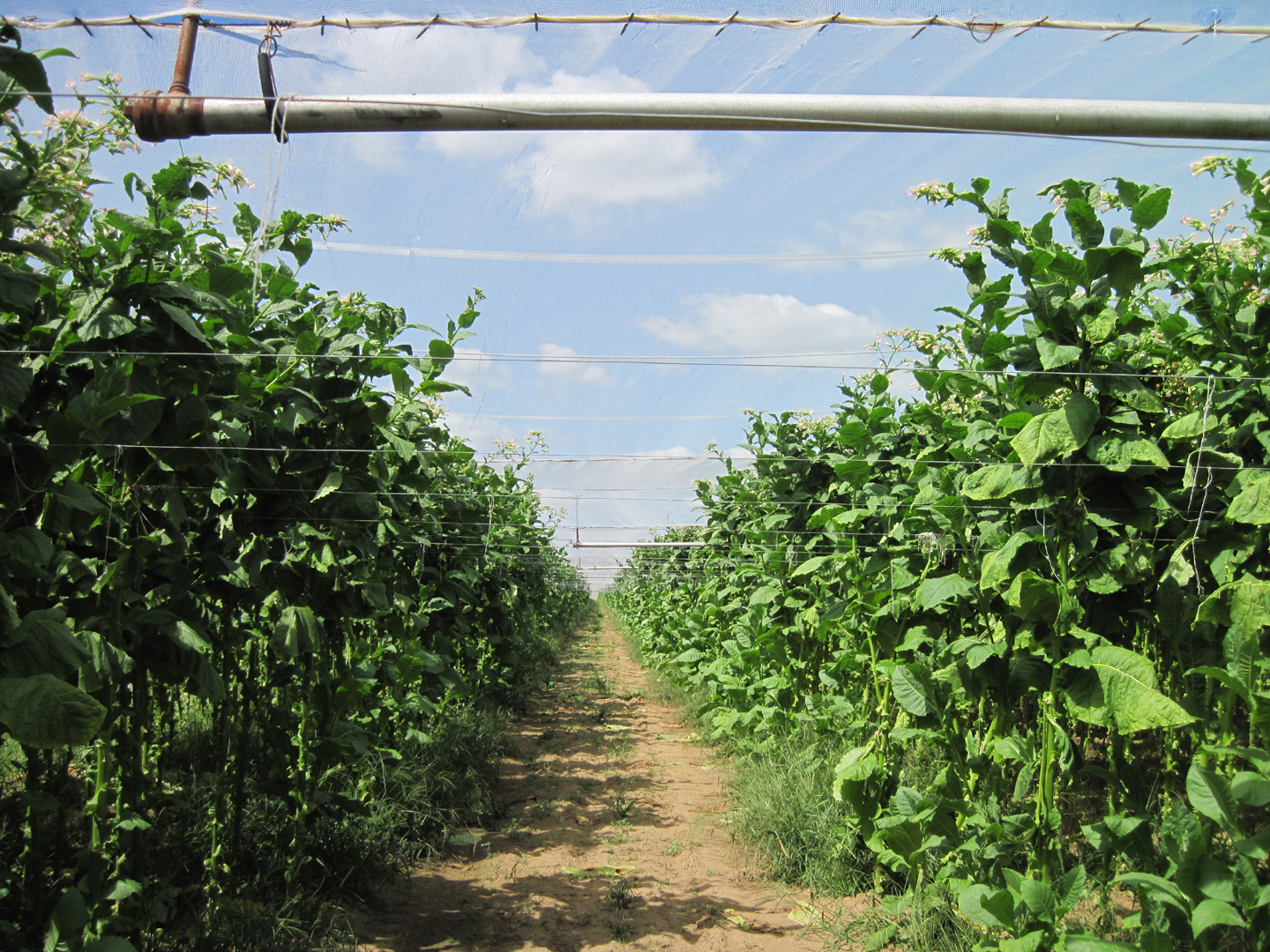
Connecticut tobacco became popular for wrapping cigars in the 1820’s, but the ‘Shade’ part didn’t come into play until the late 1800’s, when a strain from Sumatra began replacing the Connecticut plant in the cigar industry. Using shade houses made of white cotton cloth, and later synthetic materials, to diffuse the sun and increase the temperature and humidity around the plants enabled Connecticut growers to match the quality of the fine-grained Sumatran leaf.
A process change in the 1950’s that resulted in using fewer broadleaf plants as filler and a decreasing demand for cigars has meant falling acreage given to shade tobacco in Connecticut, from a high of 30,000 acres in 1921 to some 2,000 now, and the big red drying barns and the shaded fields have been disappearing, giving way to suburban housing developments and industrial parks.
The industry is well on its way to museum status, and the Connecticut Valley Tobacco Historical Society is playing a huge role in that. This society became the beneficiary of a trust fund set up by John E. Luddy, who earned his money from selling shade cloth and other items needed by growers during the heyday of the shade tobacco industry. The society’s grant to the town of Windsor resulted in establishment of a tobacco museum at Northwest Park.
Not surprisingly, it is called the Luddy/Taylor Connecticut Valley Tobacco Museum. Gordon S. Taylor was a plant pathologist who was instrumental in saving the shade tobacco industry from weather fleck and other diseases in the mid-1900’s.
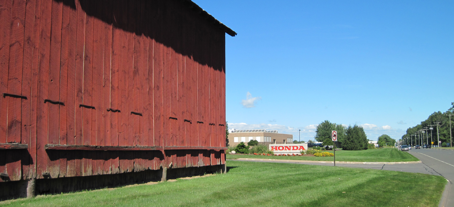
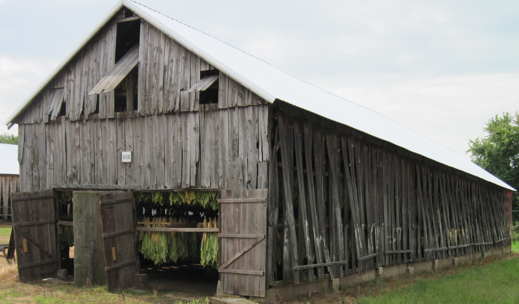
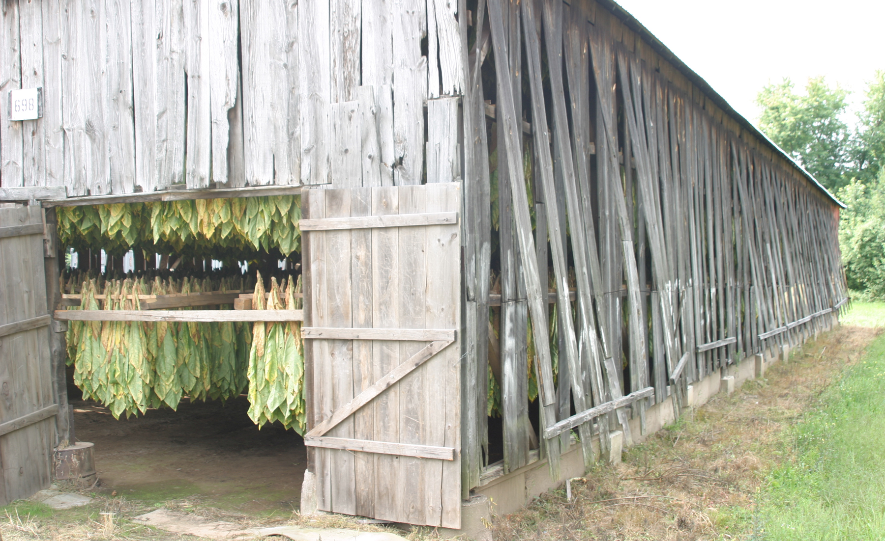
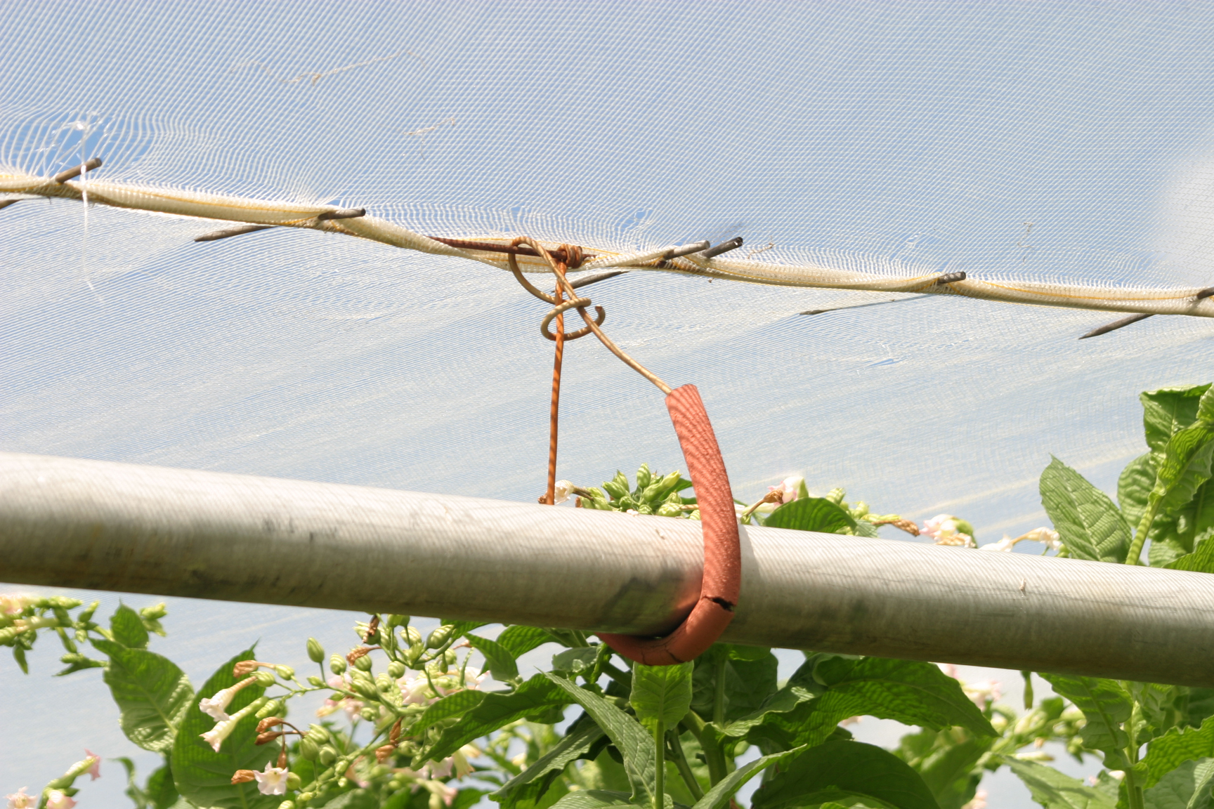
Above and below, the surviving barns and fields of a once-huge industry are now a part of suburban Hartford, taken over by traffic, houses and business parks. The one adjacent to the Honda plant even gets a finely-mowed lawn. (See 2017 update)
 The curing barns, the one below a weathered grey, boast sides that open up.
 Inside the white cloth, the ‘shade’ isn’t as dense as it would appear to be from the outside.

 At Rainbow Reservoir on the Farmington River, Windsor, CT. And a few more photos:

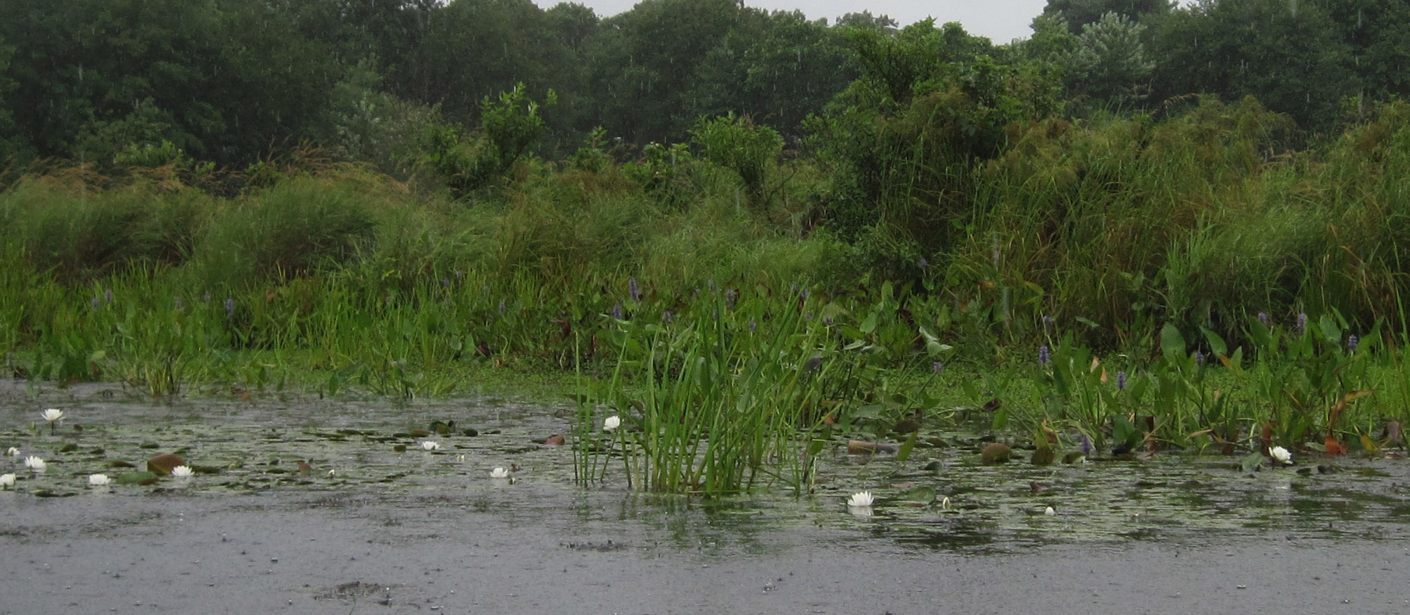
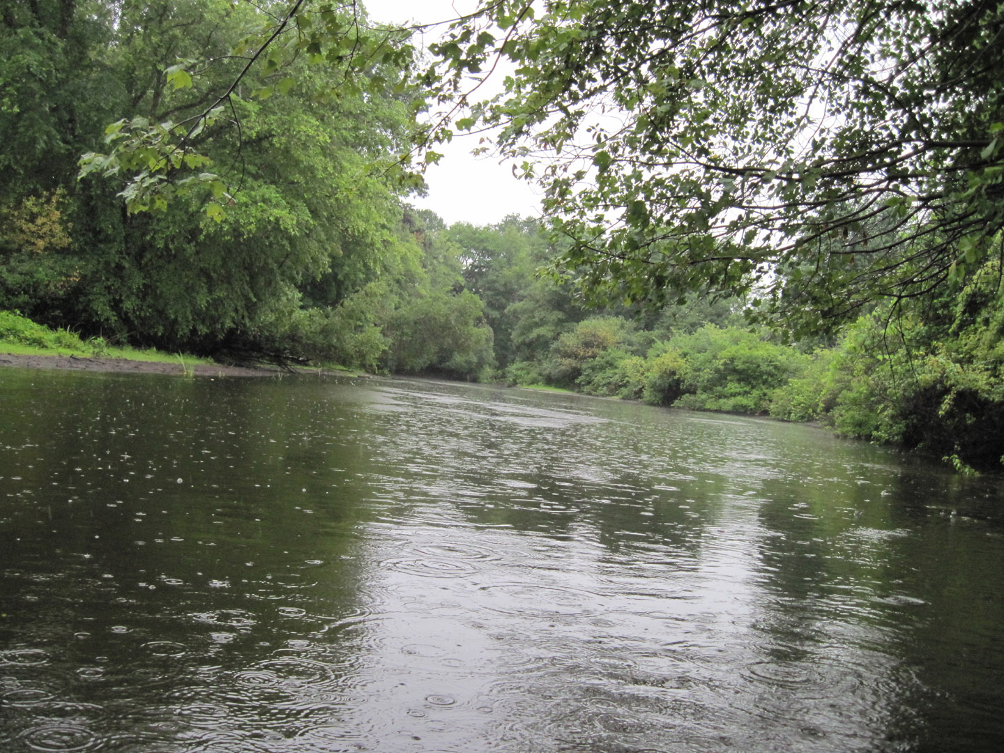
I don’t often go paddling in serious rain on purpose. The last time, actually, was on Day 47 of my Mississippi River trip, when I crawled out of the tent into a stormy looking morning intent on paddling the seven miles to Sabula, IA, no matter how hard it rained.
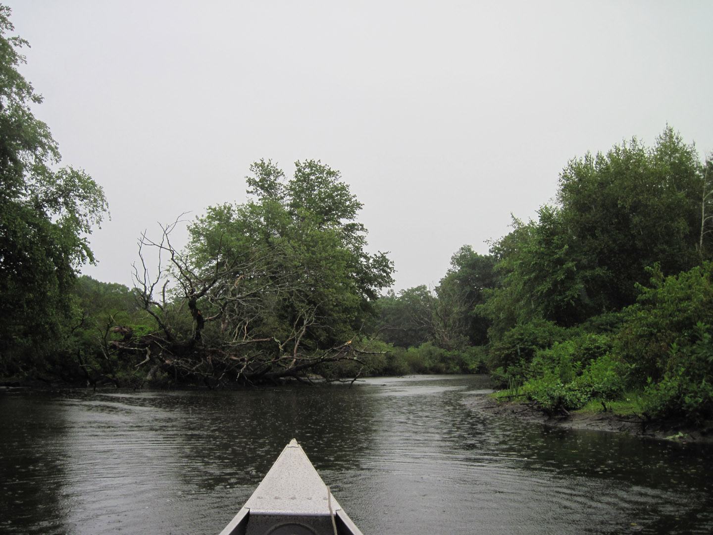
The goal this time was the 6.5-mile canoe trail on the Charles River in Dedham, MA. It’s a circle, made possible by a man-made connection between two sections of the river at the top of a long loop it makes to the south, through the town of Dedham. The half-mile connection, called the Long Ditch, was dug in 1653 by early settlers to allow greater cultivation of hay.
I’d heard about it from my friend, Al, a self-described ‘trash paddler’ who kayaks all over the place, picks up trash as he goes, and blogs about his voyages. He went in May, when the Dover gage was at 1.7 feet and he didn’t have to portage. The level was .8 for me, requiring one pretty simple portage of about 20 yards at the Needham Street Bridge.
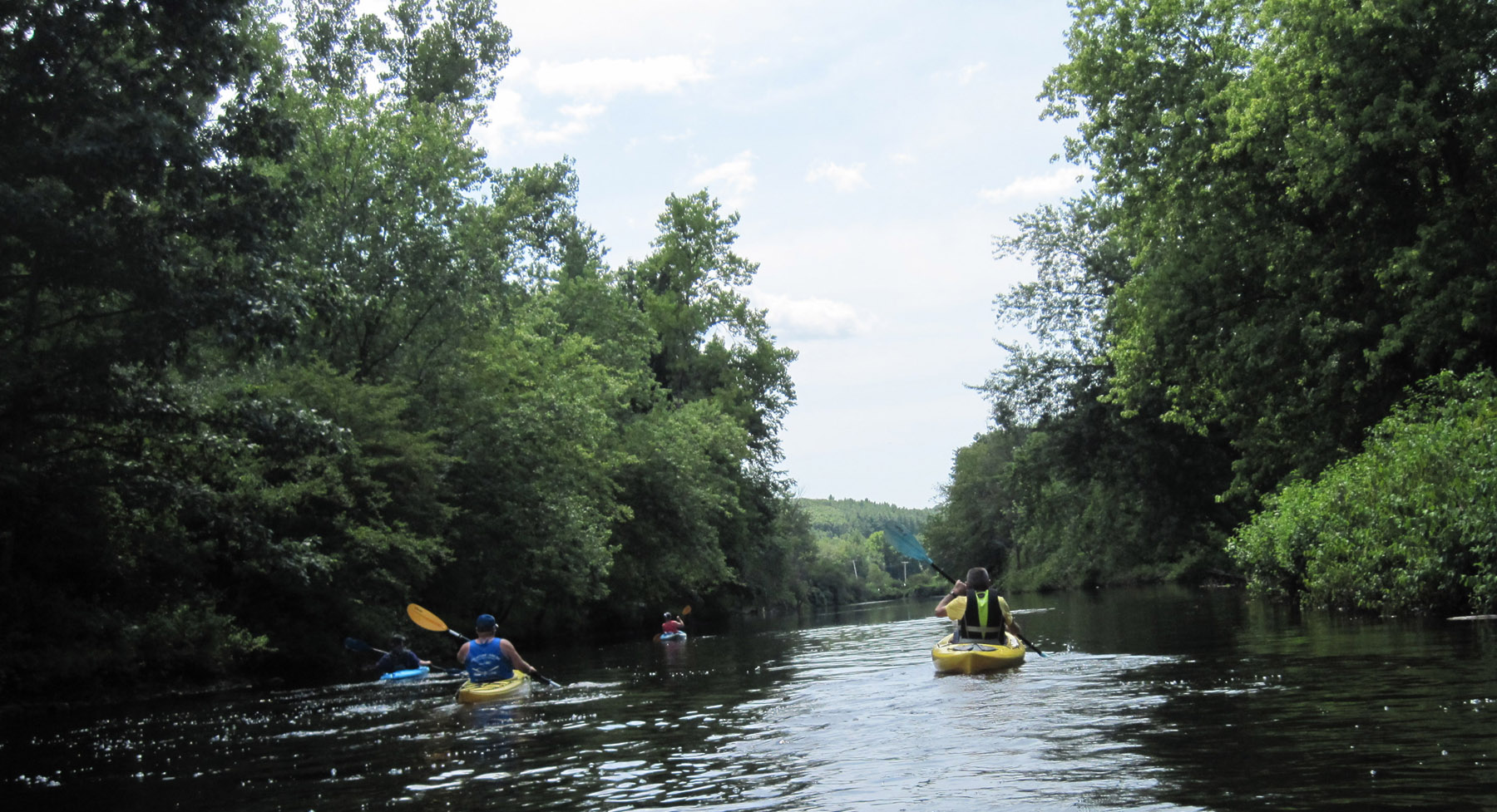
When I read Al’s account I knew I wanted to do this. I chose a date weeks ago, August 13th, and invited folks from four different paddling Meetup groups in the area to join me. As of a week before the trip, nearly 20 others had signed up to go.
As the day approached, the weather report got worse and worse. It hadn’t rained for weeks, but suddenly Wednesday, the day of my trip, became a meteorologist-designated rain day, all day, with possible thundershowers. The cancelations began, but I didn’t care, I was going to go anyway. I didn’t have an open day to postpone it to.
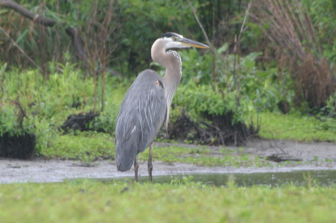
And that’s why it was just me and the ducks today. During the ride over from Hartford, with the rain hitting the windshield at 65 mph and looking like a deluge, I questioned my sanity. But my mood brightened considerably when a blue heron greeted me at the Dolan Center launch area, where I realized the rain was actually pretty light and not the torrents it had seemed to be on the road. It proved to be persistent during the nearly four hours I was out there, but not all that bothersome. A sponge kept the water in the canoe from getting very deep and a poncho kept me dry.
With the bells of a nearby church sounding the 10 a.m. hour, I set off. The slight current was helpful and the narrowness of this first section dampened the effect of the wind. At Motley Pond I spotted a building and some canoes, so wandered over. It was the boathouse at the Noble & Greenough School, a private school dating back to 1888. A helpful fellow named Mike took the time to chat and filled me in on conditions on the trail. I was happy to find out that the Long Ditch was navigable, even with low water, and the only portage was the one I’d already planned on, at Needham Street. He also described a backwater area worth exploring next time I am there.
By 11 I was at the town launch near Dedham Square. It’s not a good launch area in low water unless you’re really into wading through lots a mud to get to the water. My plan with a large group of people had been to use the launch there as a regrouping spot as we paddled, but I’ll have to rethink that.
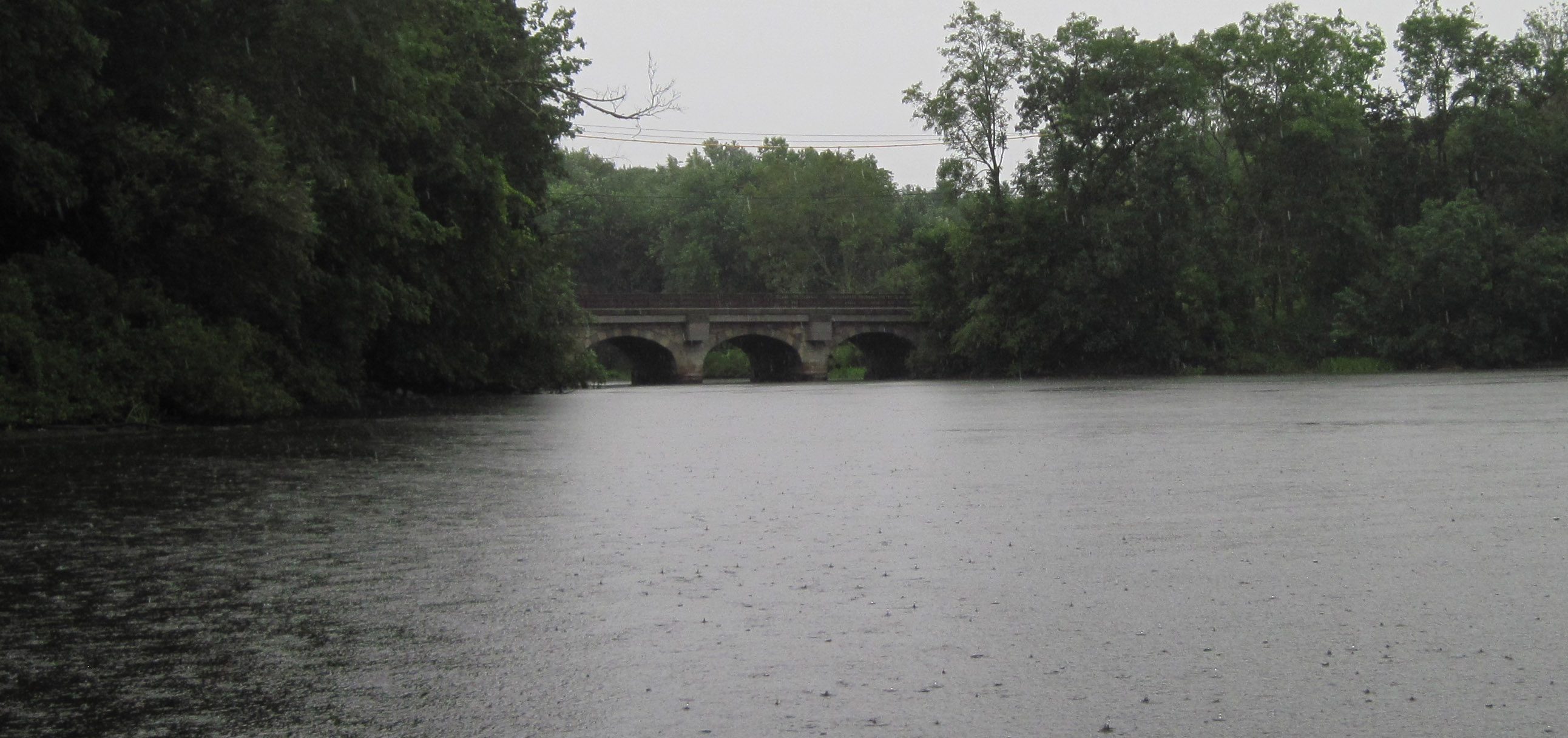
The stretch northward from the Ames Street bridge to Marie Louise Kehoe Park, another potential regrouping spot, is wider and more open to the wind than the previous section. It took me about an hour for that section. The park itself, and the town beach across the river from it, was the recreational hub of the river in the early 1900’s, and along the way to it, a couple of gathering spots, Moseley’s on the Charles and the Old Irish Alehouse, also attest to the social magnet the Charles River has been through the years. Moseley’s was built in 1905 and is one of the oldest surviving dance halls in the country. It also attracted boaters, who would anchor nearby and enjoy the music. The building housing the Alehouse, which has been serving food for more than 100 years, was home to three different canoe clubs in the early to mid-1900’s.
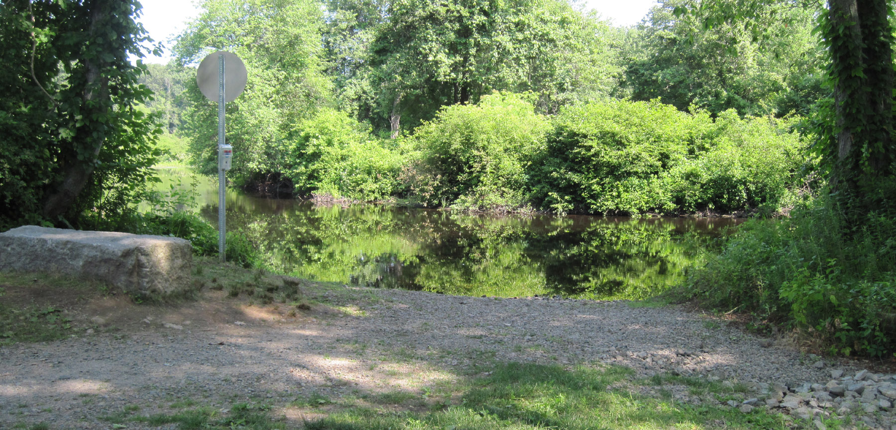
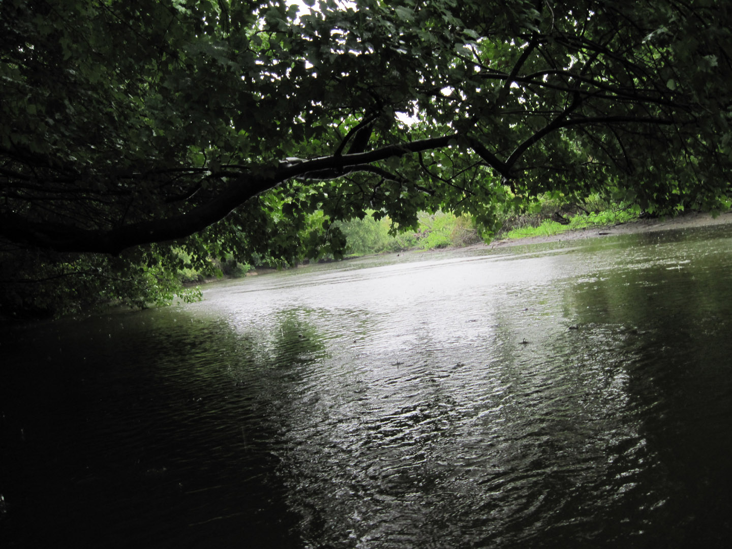
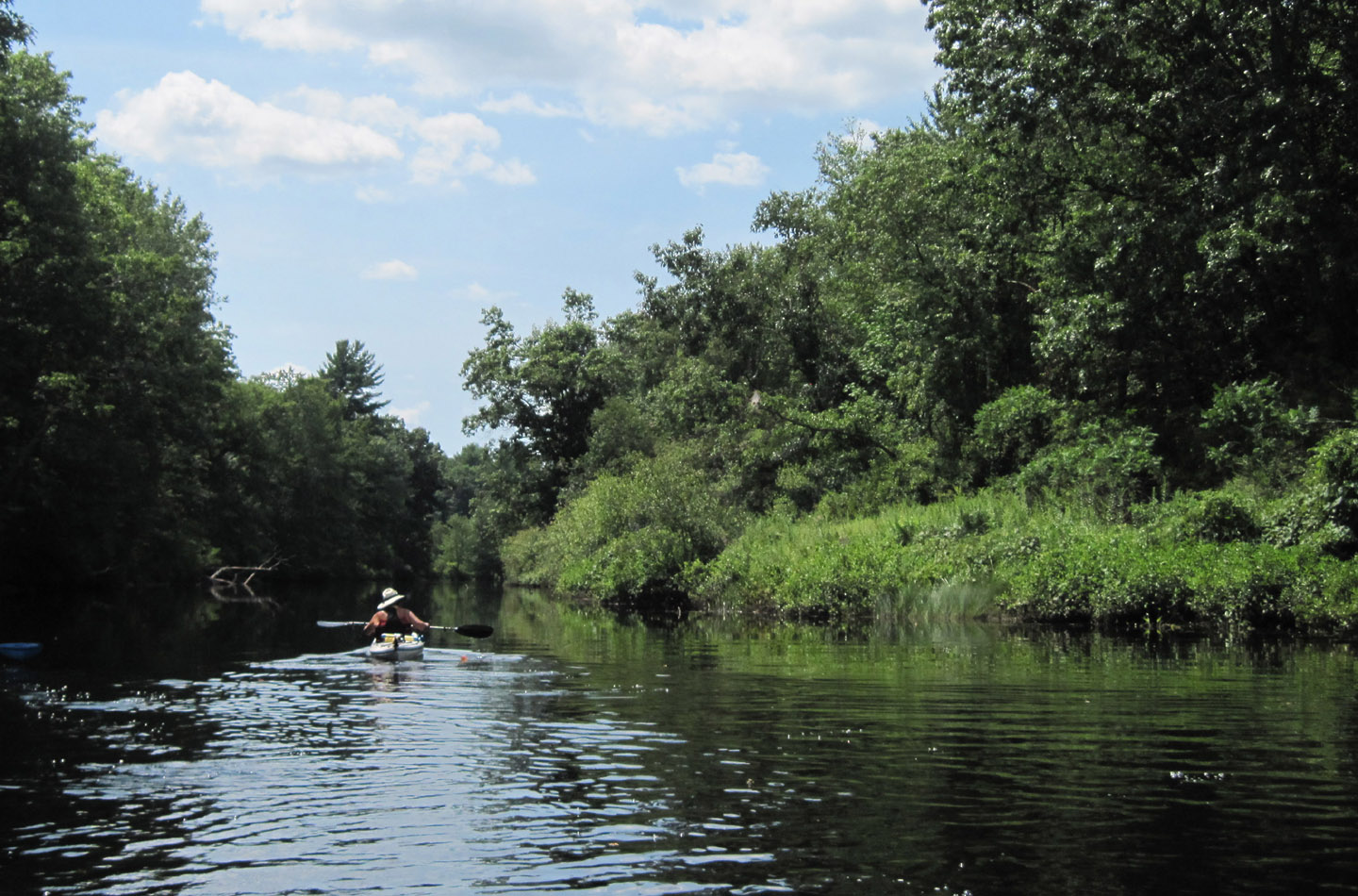
From the park the river goes north a bit, then west through Cow Island Pond, and the change of direction meant the wind was less of a bother. In a half hour I was at the entrance to the Long Ditch, on the left just before a railroad bridge. From there it was a nice, very narrow half-mile ride down to Needham Street and the 20-yard portage at the end of the Ditch.
In low water, most of the flow follows the river bed itself, not through the ditch, so once past Needham Street I felt the current pushing me again. The 45-minute paddle from there back to the Dolan launch is a pleasantly winding and narrow section. I arrived at the launch just as the church bells were hitting 1:30. And the rain stopped for the twenty minutes it took me to pack up.
Now that I know my way around this place I am sure I will go again, and invite some folks along. And I’ll pick a day when it won’t rain.
Even the ducks sought shelter once in a while.

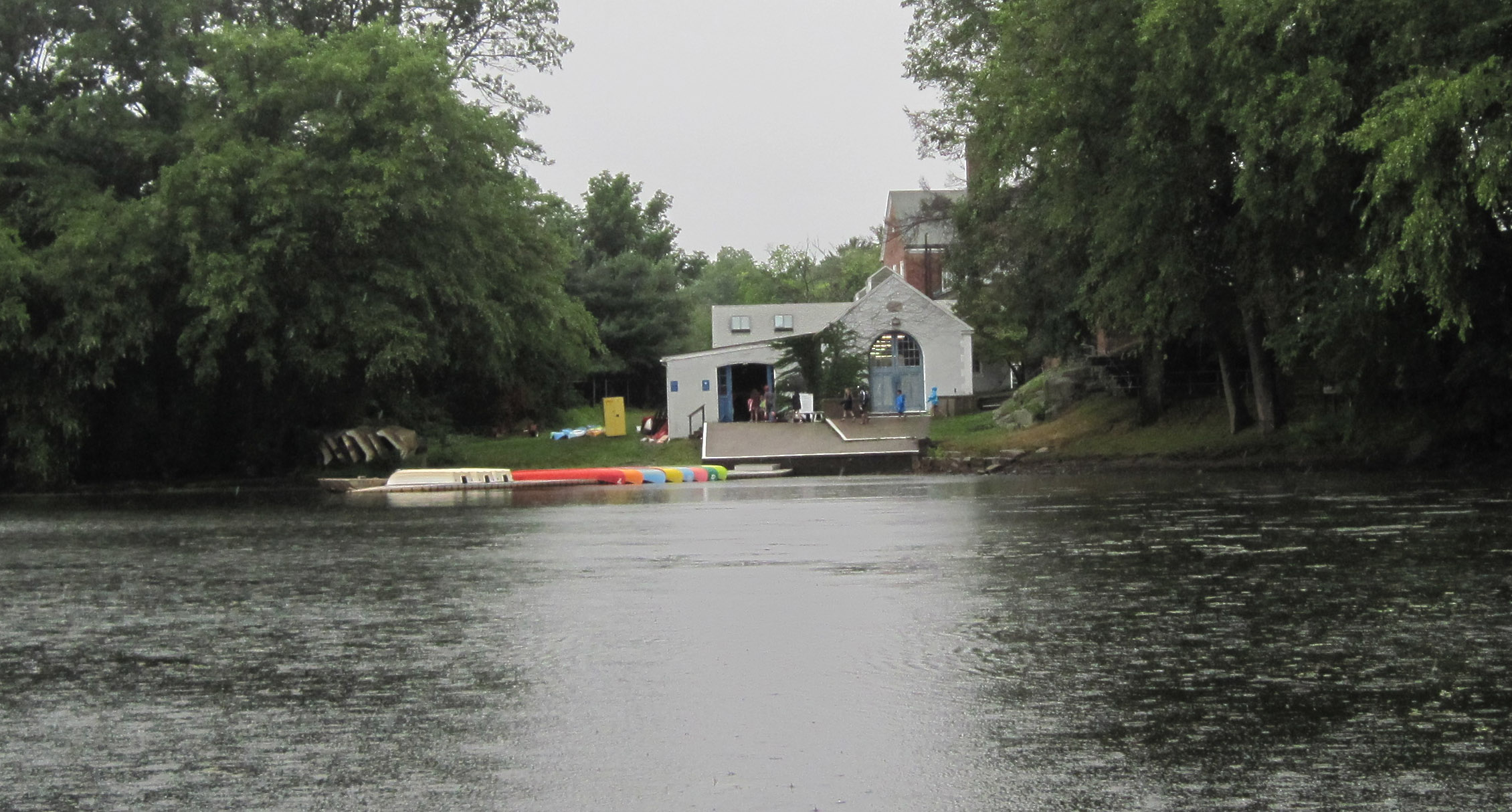
Boathouse at Noble & Greenough School
Launch area at Dolan Center
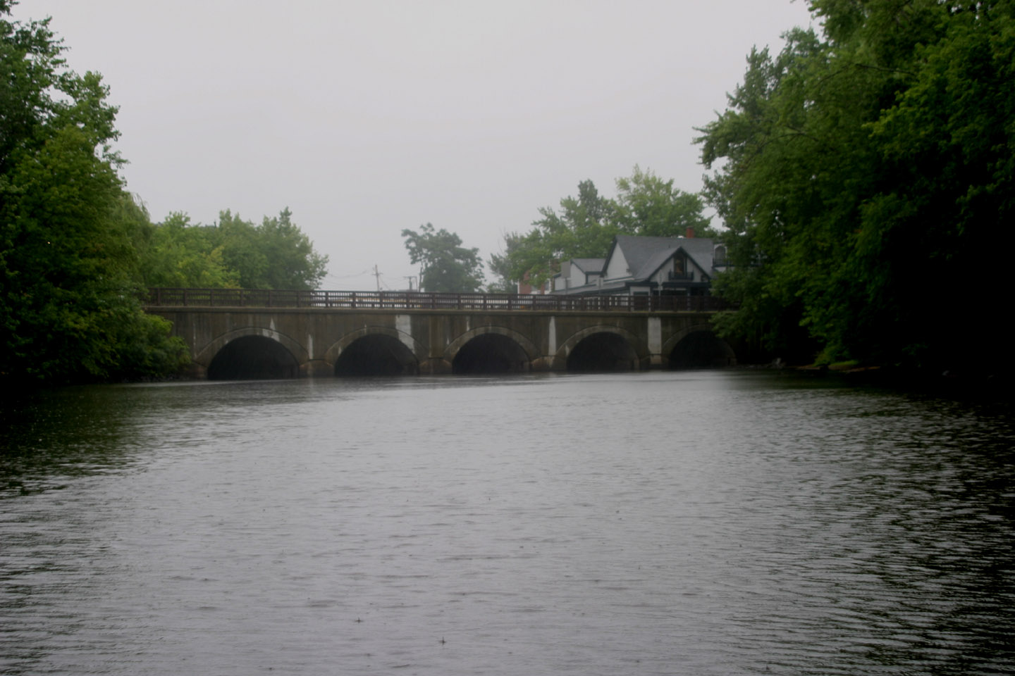
The bridge at Bridge Street. You can see the top of the Old Irish Alehouse

This and the shot below are of the entrance to the Long Ditch and the third photo is along the Ditch


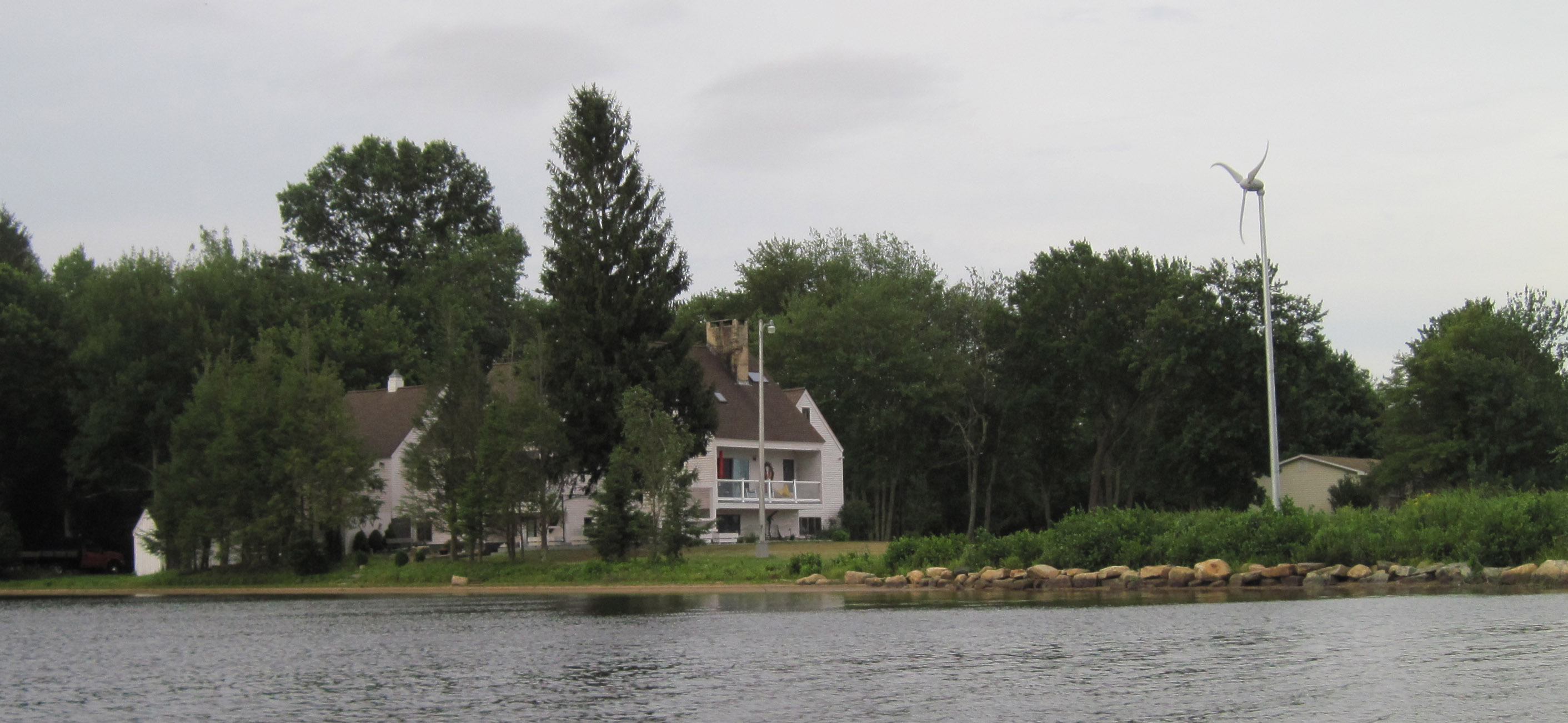
The wind was kicking up whitecaps on Pachaug Pond in Griswold, CT, tonight, so the paddle from the launch to the southeastern end of the lake was a slow crawl, but the ride back with the red umbrella was sweet indeed. I even checked out the sloughs behind some islands under umbrella power. A homeowner on the lake had a windmill to take advantage of the free energy, but a bad bearing in the thing made a screeching sound that could be heard all over. I’d hate to be his neighbor.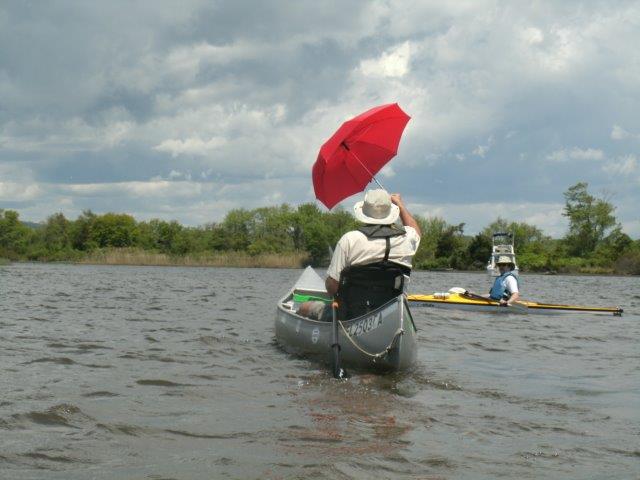


Between having to use a rental car (because of Ouch!) that I couldn’t pull a trailer with and a bout of the slight fever/feeling blah crap, I hadn’t been out in the canoe for nearly two weeks. Put an end to that today with a very nice paddle down the ‘Blue Trail’ on Millers River between Athol and Orange in Massachusetts. With good company, a nice current, perfect weather and a river-accessible ice cream stand I had all I needed for a great afternoon. Filled up the gas tank there too, of course.

History, Travel, Sports, Art, and Nonsense
Improvise, Adapt, Overcome ... and never ever give up.
Traveling one day at a time
Mississippi River - Source to Sea - Solo … but never alone.
Horses & Other Interests
I love a person, it's people I can't stand
Hear it straight from a self published author: A new post every Saturday!
Family, Running, Paddling, Life
...and where it's taken me.
...and where it's taken me.
Fitness, Adventure and Art on the High Seas!
...and where it's taken me.
...and where it's taken me.
Notes, thoughts, excerpts
. . . at least from where I'm standing.
News for those who served with the Peace Corps in Eritrea and Ethiopia.
A little red pen goes a long way.
The latest news on WordPress.com and the WordPress community.
